Monday, April 30, 2007

Bunker Touring in Berlin

[UPDATE [July, 2, 2010]: The images that were once seen here on this post have been removed due to request from Holger Happel of Berlin Underworld's Association. Sadly, this organization has a very active web policing apparatus that denied me permission to use the images from its website in mention of them here. Why, I have no idea. Subtopia makes no money, doesn't even have a single advertisement. If anything, we here are providing a good free advertisement for Berlin Underworld, which they have failed to appreciate in even the most minimal of manners. So, screw them! And so much for bringing Berlin's Underworld to light!]

More exciting than the surface of the city itself can often times be perhaps a city’s underground, that vast dark reciprocal hollowed space that some how helps prop up everything above it, a colossal settlement, a global city. I’m always blown away thinking about how so much urban weight can rest on essentially a tangled network of constructed voids, or an infrastructure of more or less empty space.

Much of what we can’t see in a city is what sometimes fascinates me the most. For example, we can sit back from the right distance and look at the city, glimpsing it in all its grandeur – in the totality of its being framed in a single glance. But, that is a perspective we can never achieve with the underground – it is marvelously un-seeable this way and therefore emblazes our imagination with fits of subterranean landscape speculation. Instead, we can only imagine a massive skeleton of transit tubes and secret chambers some how coming together to magically lift an entire city skyline up and over the horizon.

But, in that secluded, restricted, privatized sub-city where old histories silently linger and whole populations of urban secrets are engraved in the spaces of formal and informal architecture – where military and urban planning join, or homeless camps and fall out shelters cross paths, that overlap of use is what I find particularly intriguing. It is the thriving unknown city that cannot be seen which aches for my attention.

Well, ever since the Nazi era Berlin has (to some degree) existed in this kind of shrouded urban parallel, and I am still annoyed that I have yet to make it there. Especially after coming across this article which introduced me to the Berlin Underworlds Association, “a non- profit group founded 10 years ago" that broke "a long held German taboo by erecting a shield pinpointing the notorious underground bunker site.”
Apparently, the group has grown and now organizes “selected tours of remaining World War II bunkers and shelters in and around the city.” Now, bunker touring may be nothing new, but Berlin does offer quite a subtopian treat since close to “1,000 underground bunkers were built during the Nazi era” for which close to a third have survived.

The article lays out a few spots that are worth checking out, like the Kurfuerstendamm, or “a prime example of bunker architecture” that persists at the corner of Albrecht and Reinhardtstrasse close to the Deutsches Theater in Berlin. There is of course the Tempelhof Airport (that may actually be turned into some kind of opulent beauty clinic), or, perhaps the most popular site “found at the Pankstrasse underground (U-Bahn station).”


But, just as old bunkers are opened up to the intrigued throngs of global tourism new bunkers take their shape if only so far in the public’s imagination as rumours swirl over the government’s plan to build “a “new” 220-million-euro Interior Ministry premises in Moabit,” to - hypothetically - make up for the lack of a bunker in the old premises. I wonder, how much volumetric space is taken up in underground bunkers, how much air capacity exists trapped in these concrete structures? I've asked this before, but could we estimate exactly how much real estate, or in this case, air space, is devoted around the world to the underground?

Nevertheless, if you are in Berlin, or are headed there, it would more than likely be unbelievably cool to go visit the Berlin Underworlds Association and tour the old vintage bunker cities of Nazi Germany. Hell, tell ‘em you’re a reporter for some crazy website called Subtopia and your researching for a book on post-military landscapes and spaces of global underground refuge and see what they say – who knows, they might open up some secret vaults just for you! You never know, I mean, I'm just saying - keep hope alive!

(All images were taken from the Berlin Underworlds Association website, except for the Tempelhof Airport, which comes to us via Regine.)

[See these earlier posts on bunkers: Bunker Sprawl; Touring the Greenbrier; Secret Cities of the A-Bomb; Area 71; Washington's New 'Survival City'; A Silo Full of Cash; Secret Soviet Submarine Base; Fortress Baghdad; The 'Long War' enters its capsule; Subterranean Urbanism; Tokyo Secret City; Bunker Archaeology; Smugglers' Paradise Uprooted; [Re] improvising sub_Base landscapes; Secret Synagogue; Mt. Seemore and the watchful gaze; from Leftover-Bunkers to Tourist-Traps...; A "Closed Atomic City": Open for Business]

The Great Urban Divide


[Image: Adhamiya, Baghdad, Iraq. Ali Haider European Pressphoto Agency, NYT - 2007.]

If there is anything good to become of the American strategy to wall off strategic neighborhoods in Baghdad (besides the ironic perhaps even temporary solidarity of the Sunnis and Shiites) it is that -- at the very least -- everyone is talking about it: the idea of using urban dividers to engineer political discipline. At least the general topic has reached a new high in mainstream dinner conversation, I suppose.
An article from the weekend’s New York Times gives us a little history on the use of physical walls in imposing a political obedience on people in old Malaysia and more recently in Vietnam.
Tim Weiner writes about Britain “At the close of their colonial era, after World War II” when “they isolated the ethnic Chinese population in Malaya, building “new villages” and herding hundreds of thousands of people into them.” Literally like an architectural filtration system the walls, as we have seen in numerous places over time, are not only used to control entire populations, but essentially to push a discipline onto them. After the Brits segregated a portion of the Chinese behind barbed wire fences, Weiner tells us, they (the Brits) attacked the Chinese insurgents beyond the walls. Hmmm….I’m not sure who the winner is supposed to be in that scenario.

[Image: The Berlin Wall, as photographed by Ernst Haas/Getty Images, NYT - 2007.]

In his piece we are also reminded of the U.S.’s occupation of Vietnam and how they “were never skillful enough — or tough enough,” he says, “to sort out their foes, the Vietcong insurgents, from their South Vietnamese friends behind the stockade fences of their “strategic hamlets.””
Yet, despite this not too distant historic failure the Americans have put their hopes in the same strategic basket in Baghdad, where the entrenchment of the insurgency is just as deep and inseparable as the civilian population if not vastly more sophisticated. I mean, how many more parallels can be drawn between Iraq and Vietnam? Iraq is literally becoming a cumulative representation of all that has gone wrong in imperial conflict before it.
Weiner refers to these as the “walls of war – the architecture of long struggle.”
More interesting though is his reference to David Galula, a French military officer who fought Algerian rebels in their war of independence 50 years ago.
“If we distinguish between people and rebels, then we have a chance,” he wrote. But that is only a start: “Political, social, economic and other reforms, however much they ought to be wanted and popular, are inoperative when offered while the insurgent still controls the population.”

He continued: “So intricate is the interplay between political and military actions that they cannot be tidily separated; on the contrary, every military move has to be weighed with regard to its political effects.”

A simple but telling final statement. Anyway, the rest of the article is worth reading, and in case you missed it – check out our last post that outlines a partial geography of the worldwide spread of global border walls and militarized fences. Surely the militarization of the border or use of high-security gated communities is not endemic to Iraq alone.

(Thanks to Rob and Geoff for passing the Times piece my way.)

Tuesday, April 24, 2007

Border to Border, Wall to Wall, Fence to Fence

It’s been a while since I updated you all on the development of recent global border fence infill – if I may call it that – which has cropped up in the past few months and with no signs of slowing down since my last post on this topic in January. In fact, you might say the opposite is true.


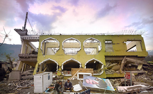
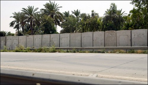
[Image: A picture of the wall being built around the Sunni neighborhood of Adhamiyah in Baghdad. Photo via France 24.]

The self-referential nature of this border fence spawn all around the world is so intriguing in part because of the rapidity at which they are being proposed, built and contested. This hyper-construction also seems to mimic the rate at which more central stages of geopolitical division are continuing to descend into deeper political chaos. How can we not see all of these security barriers amounting to a much greater architectural system of exclusionary spatial practice, emanating from severe fractures and tensions in the tectonic integrity of neoliberalist expansion?


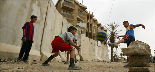
[Image: An Iraqi boy squeezes through a gap in a stretch of security barrier erected in Baghdad's Azamiyah neighborhood. Photo via SFGate.]

These borders are produced by both global and local economic pressures, and selectively admit and deny the passage of people on various levels of identification and entry, through formal welcoming gates as well as more clandestinized spaces of violence. While some pass daily in seas of commuter traffic, others are forced to tunnel along underground superhighways where death is already prefigured into the massive concrete sewer corridors which have acted as mass graves for imperiled migrants now for years. While some are biometrically scanned and bureaucratically approved, others forfeit their identities and their limbs while clinging to the sides of trains roaring towards the northern Gringo Land long past midnight. Some are given long term visas while others merely a day pass. There are those who are forced across in shackles or blindfolds while others hide in the chairs or dashboards of smuggler vehicles, passing small hordes going the reverse direction gleefully driving their RV’s across the border with their dogs and families. There are sub-compartmentalized dimensions of secret clearances and private institutional permission, and other covert crossings contrasted by a much more spectacular fringe of constant cross-border activity – while most of the divided territories are masked in the expanse of a natural landscape making the nations all the more impossible to distinguish. And while the birds and the bees travel back and forth as easily as the wind, other multidirectional flows of traffic are directed by a matrix of military surveillance grids and counter cartographies of guerilla subversion.

Today’s border evolution, with entire Fence Laboratories devoted to its securitzed sophistication, frighteningly strives towards a perfect technomilitaristic artifice of perhaps (dare I even say) an apartheid sublime; or, a kind of hyper-wall that can filter – in some automated caste system-like surveillance regime – the socio-economic and racial identification of any person who seeks to pass. It becomes a membrane through which various advents of space and biopolitical hierarchy open up – it’s the kind of wall you might expect one day in the grimmest of futures to surveillance the world all on its own. But, I digress and get carried away, however, so…forgive me.

When I think about places like Iraq or the West Bank, or parts around India and La Linea that’s being accentuated by a series of individual smaller fences along side Mexico, the overall effect looms over these continents as if governed by a grand tyranny of border fencing, like these barriers were the physical manifestations of an entire political system that only existed in built form, in architectural divisions – an institution of intelligent border fences; or, rather as a pervasive urban consequence to a much larger and more abstract bureaucratic phenomenon. All of these fences some how simplify the cruel complexity of today’s global politics and pervert the final frontier of human rights that is the freedom of movement.

Obvious frontiers like Jerusalem and Baghdad seem like the heads of this massive snake; the critical geopolitical pressure cookers from where the rest of the political climates across the globe are regulated and controlled. With recent stories focusing on Baghdad and the American military’s rogue plan to build a massive three-mile long wall around the Sunni enclave of Adhamiyah, this is as good a time as any to relay some other stories I’ve come across with regards to the seemingly endless construction of a global border. Though, you’ll have to forgive some of the larger at length quoting and excerpting from some of these articles while I try to sum up the consistency of this divisive proliferation.


[Image: From 'Gated Communities' For the War-Ravaged' in the Washington Post. Photo by Wathiq Khuzaie (Getty Images).]

So, you’ve no doubt heard by now about the controversial plan American military strategists hatched to build a massive concrete wall around the neighborhood of Adhamiyah in Baghdad. This, the Americans said, was part of a larger effort to secure the area and prevent terrorist movements within the neighborhood. It was of course billed as a protective measure for the Sunnis, even referring to it as a “center piece” for a larger objective of turning different neighborhoods through out Baghdad into “gated communities” that would by some stroke of miracle stem the uncontrollable sectarian violence.

Only thing is: neither the local Sunnis or Shiites are down with it. Even less surprising, the American government didn’t really consult with anyone prior, not even the Iraqi PM who announced his own total disapproval of the wall and ordered its construction to be halted. Did the American government really think that anyone in the Arab community would embrace the idea of extending a wall through out their ancient city – I mean, given the tantamount associations most Arabs have with the Israeli wall that has literally carved the Palestinian people out of Jerusalem and into peri-urban prison-like reservations?

Needless to say, Jerusalem and Baghdad are looking more and more similar despite these massive 12 foot high concrete walls segregating the different religious sects. So far, 3,000 separate slabs of concrete blast wall have been placed around the Sunni city since the plan was put into action 2 months ago, each weighing roughly 14,000 pounds. “These barriers included both Jersey barriers — short concrete dividers commonly seen on roadways in the United States — and larger 20-foot blast walls that commonly surround bases and living areas.”


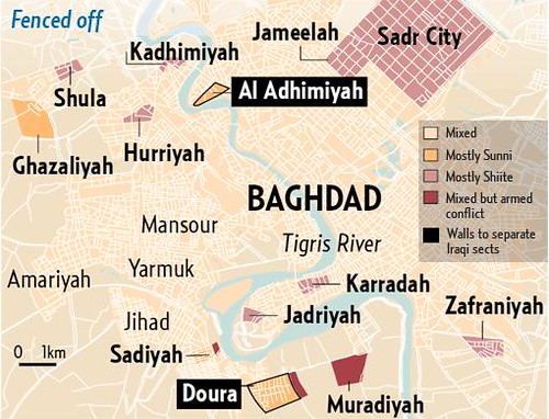
[Image: Entrances to and exits from Al Adhamiyah will be manned by Iraqi soldiers. The wall will be five kilometres long and include sections as tall as 3.5 metres. Map via Gulf News.]

According to this article, “Besides Adhamiyah, barriers are going up in Ghaziliyah, Khadra and Ameriyah in western Baghdad - all Sunni areas - and three are being built in the southern Rashid district in locations that officials didn't specify.”

However, this latest dispatch from the Washington Post, says the U.S. is defending its plan to construct the wall and is proceeding with sealing at least 10 neighborhoods despite opposition from Iraqi leaders. In addition, U.S. forces are also planning to use biometric technology to track residents in Baghdad, while troops are also actively compiling neighborhood census data by recording the fingerprints and eye patterns of locals.

Of course, the greatest “gated community” in Iraq is the Green Zone, but even that compound was recently attacked by someone who’d managed to circumnavigate security and get within reach of the Parliament building. Bottom line is, and Anthony Cordesman, a Middle East expert at the Center for Strategic and International Studies in Washington, D.C confirms as much (in the same article), the walls – while creating a certain degree of protection – only further adds to the sectarian violence. At best, it is a dismal short term solution with much more severe long term repercussions. A recent piece by Alissa Rubin in the New York Times does a good job of articulating how demeaning the gesture of the wall is – as if that were the only solution the Americans could come up with after what they have let become of Iraq post-Saddam. Actions like these make it more and more apparent to me how the military is capable of engineering spaces of conflict; their walls and checkpoints not only produce conflict zones, but exacerbate them once they already exist. The Americans looks so ignorant of their own failure that they must stoop to these types of last ditch efforts and “banal militarism.” Though, Rubin’s piece points out an interesting irony, that the wall has actually united the Sunnis and Shiites. Perhaps an inadvertent consequence of the American’s poor idea? At least there is some positive side effect.

It’s absurd, but what if the American military went on a lonely wall-erecting spree with the intention of pissing off the entire Arab community so badly that the sectarian violence came together in a massive re-solidarity of their nation-states to oppose the wall, or this network of American walls? Yes, it’s insidious and I would not promote such a tactic, but if the ignorance of the wall could some how be compensated by the good fortune of actual unity, and not increased sectarian violence as these walls conjure. Everyone knows that these walls only ratchet up to boiling points the political violence so that these “gated communities” in the end function more like strategic pressure cookers where violence can froth over in designated frontiers within the city instead of less predictable spaces. This become a way of forcing the warfare into controlled areas, but at the cost of increasing the tensions.

But, that’s only a snippet of the border-plagued urbanism that haunts the internal spaces of the nation’s capital, the external boundary of Iraq itself is also seeing tremendous rapid transformation. The CBS News reported back in January that “More than 40 Iraqi military installations now dot Iraq's border with Iran,” and the coalition just finished establishing another 200 along Iraq’s other borders. The Zurbathia port of entry is one of the closest to the Iraqi capital, and apparently considered the "center of gravity where many security problems exist. The piece talks about the practical issues of training more border agents, lacking the means to properly house them along the border (as most already live in decrepit modular housing units), and some of the less formidable checkpoints between Iran and Iraq that signify the flexing political clout and military build up that is being exhibited by Iran.


That’s not the only border Iran is worried about, though. They’ve recently begun construction of “a 700 km-long concrete wall along its border with Pakistan.” Just west of Quetta, the wall is being built from the nearby border town of Taftan. And, typical with most border fencing, it isn’t stopping for anything in its path either. From this article, “Residents of the Sorap locality in the Mand area of western Mekran region in Balochistan province told a group of journalists visiting the area that they did not know why the Iranian border forces were asking them to leave their homes.” Without much more warning than that, the Iranian government gave this Pakistani border town just 10 days to abandon their lives there.

But before we make our jaunt over to Pakistan, let me quickly finish this mini-tour of the Middle East’s barricade frenzy.

Apparently, “a prominent sheik of the Wayilah tribe” living along the border between Yemen and Saudi Arabia, threatened to fight the Saudi Arabian government for building “a security fence 4 to 7 km beyond the neutral zone inside Yemen, stretching from Jabal Hobash to Jabal Al Fara.” With some extra nudging from Egypt and the U.S., the Saudi government “did accept to remove the separation fence along its border with Yemen.”


Of course, no mention of the Middle East in terms of borders could be complete without some dispatch of the latest developments along Israel’s borders. Similar to the fence that already exists along the Jordanian border, a project is in the works to add West Bank-style concrete wall barriers in the southern end of the Egyptian/Israeli border where territory there has been grounds for smugglers and attacks against Israelis in the Sinai. According to Ynetnews.com in Novemebr 2006 the IDF was reported as saying that it plans to erect an electrical fence starting from its most southern tip in Egypt. Even more recently Israeli defense minister Amir Peretz told the newspaper Yeodit Aharanot that the first phase of the project will stretch along 14 kilometers of the border from Ilat extending north. Interesting enough, the press also reported that a French company would be involved with the barrier construction there.


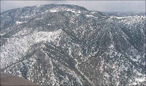
[Image: This is a glimpse of the vast border between Pakistan and Afghanistan as photographed by the BBC in High stakes on Pakistan-Afghan border.]

Meanwhile, Pakistan, after announcing its plan a few months ago to fence (but no longer mine) large fronts of its border with Afghanistan to restrict the movement of Taliban militants, has said “the erection of the fence in seven or eight different pieces will take a few months to execute. However, after flying journalists over mountain tops across the border where “simple markers” merely suggest this border, “and occasional white numbers painted onto mountain tops rise from a wilderness of barren ridges and dried-up creek beds,”Afghan troops have already torn down parts of the fence that have been erected, even exchanging gun fire.


The Foreign Ministry said just a few hours ago that it would use everything in its means to prevent a fence from being built along their border. ‘We will use all legal tools to stop this fence,’ he said. ‘It is not a solution to crossborder attacks, it divides families living in the area.’
Oh the power of walls. Will the Pak/Afghan border become more unstable than ever? I can’t see that being an unsafe bet.


And while we’re in the region, as amicable as India and Pakistan have become in a recent history, the militarization of their borders is still firmly entrenched and sighted on watching the every movements of each other. In The Hindu, we read:

Pakistan has built dozens of new concrete bunkers since the ceasefire, often just metres from the border fence in the Jaurian sector, near Jammu. Two concrete bunkers, for example, now overlook the fence at the BSF's Nikowal Border Observation Post. Should the Pakistan Rangers choose to do so, these bunkers could be used to bring down lethal fire on Indian patrols and counter-infiltration ambushes.

New observation towers, which allow the Pakistan Rangers to closely monitor India's forward positions and troop movements, have also mushroomed throughout the Jaurian sector. Elsewhere in the Jammu region, Pakistani troops have been building new roads and repairing bridges leading to its forward positions — all activities facilitated by the fact that construction workers are no longer being shot at.

India has responded by starting work on a new earth bund, or dyke, from which border guards will have an unobstructed view of the fence — and also be able to dominate the new Pakistan Rangers bunkers. An old dyke which obstructs the BSF troops' view of the border — built, ironically enough, to protect workers building the fence from Pakistani fire — will soon be levelled, clearing the way for more accurate fire targeting infiltrators.

It sounds so childish and back and forth. Tit-for-tat. Like Siamese twins posturing with one another, victims of inseparable self-conflict. Oh yeah? I’ll see your observation towers with this earth bund. Oh yeah?? But that doesn’t stop them from getting together to bless the border fence in the spirit of Holi; truly a border celebration that could only happen on the border of India. Come on, check out this video and chant along now:

"Jo shanty chal rahi hai border pe, us hum yeh programme kar rahe hai, Hum log alag states ke rahne wale hain aur jab sare sates ke naach-gane mil jate hai, toh ish Holi ki rang hi kuch alag ban jata hai…”

(In their own English translations: The peace on the borders is a good sign and we can celebrate then … Since we all come from different regions, when different shades of colours mingle, Holi gets an altogether different hue here... It does not matter which region you come from or which community you belong to, we celebrate without any divides.”)

What can I say – I’m down.

I find India the most fascinating country, not just because I spent four months there blown away by the other-planetary nature of the place, but because India ever since the British empire retreated has made every attempt to border itself on all fronts. Just last months the Indian government proposed to fence the Indo-Burma border, and asked the Burmese military junta to cooperate. Mizzima News reported that “The fencing is deemed necessary to check rampant cross border crime, smuggling, insurgency and other illegal activities.” The current objective is to fence approximately 10 of the 1,643 km border, which “is used as a safe haven both by insurgents and smugglers, has been is a bone of contention and concern with India.”

Meanwhile, India, as part of the Kaladan multipurpose project, has agreed to invest US $103 million to develop Sittwe port on Burma's northern coast, which will allow India to conduct trade directly with Southeast Asia.

From India Defence:

“Kaladan project, which includes a 160-kilometre long waterway from Sithway to Mizoram. A sixty-five kilometre long concrete road will also be built in addition to a trilateral road joining More in Manipur, Mairat in Thailand via Bagan in Myanmar.

Mukherjee said talks on constructing a direct gas pipeline between India and Myanmar also featured during the bilateral discussions. He said concerned authorities in Myanmar were working out on the possibilities and logistics so that India got uninterrupted gas supply at a competitive price.”

It pretty much looks like an exchange of military favors for key port development with the intention of strengthening economic ties between the two countries. What kinds of military equipment? Well, who knows, perhaps in the future the Indo-Burma border will eventually be linked up via satellite with the 582 border outposts that string along the Nepalese and Bhutan borders of which the Indian Sashastra Seema Bal (SSB) has just launched a state-of-the-art surveillance border networking project to forge a detection net in between all of the gaps between the outposts there. But, this kind of technology seems like it could one day perhaps even link up to a more global span of virtual fences.

Moving on we hear that Thailand and Malaysia have agreed to extend a border security wall by another 10 km’s. The state media ran a story in March that described this extension as more than quadrupling the length of an existing 3-km-long fence near Sadao, a Thai border town 750 km’s south of Bangkok just opposite Malaysia’s Kedah state. From the article, “Thai Prime Minister Surayud Chulanont on Sunday proposed extending the existing border wall by 27 km’s to improve security in the deep South” to (take a guess)… “prevent the flow of illegal workers across the common border.”

“The wall would presumably also prevent Thai separatists from fleeing across the border after perpetrating attacks in Thailand. […] Thailand's deep South - comprising Naratiwat, Pattani and Yala provinces - has been the scene of a separatist struggle for the past five decades.”

In addition, a new 150m-long wall modeled after the aforementioned, is currently under construction near Lubok Antu in Sri Aman division in Kuching to also “deter the entry of illegal immigrants and smugglers.”

In order to move on from the Asia Pacific, of which I am leaving out more than I care to, let me just say that some good news can occasionally come out of all of this. For example, South Korea committed to a plan to dismantle parts of a wire fence built that was in the 1950’s to prevent infiltration by North Korean agents. The fence lines a river connecting the capital of Seoul to North Korea. To quote this article:

The barbed wire fences were installed along the Han River running through Seoul right after the 1950-53 Korean War -- which ended in a truce rather than a peace treaty -- over concerns that North Korean commandoes could use the waterway to infiltrate the South.

The ministry and the city of Gimpo, west of Seoul, said they agreed in principle to dismantle a 8.1-mile section of the southern end of the fence as well as a similar length of the fence set up on the other side of the river.

The ministry declined to give the total length of the fences, saying it was a military secret. But looking at a map, the fence likely stretches well over 60miles.

Currently these fences are seen an inhibiting regional development, and SK’s views of NK have softened over the years, with less worry about NK infiltrators using the river to enter into SK. Though, SK officials plan to “install closed circuit cameras, infrared cameras and other surveillance equipment after dismantling the fences.”

The decision came after years of petitioning by local governments who have pushed the military to open up this specific region for larger and more productive civilian use.


[Image: the Great Wall of China, as phoographed by Shi Gororui.]

And China, being the proprietor of the MacDaddy wall of them all, is finally getting their act together to conduct a four-year study beginning in May to completely map the route of the Great Wall in 13 provinces, check its conditions, and determine what if any archaeological maintenance should be done. After 2,000 years of boasting the world’s largest single man-made structure, I think it is fair to say – about time!

Ok, in order to wrap up this post, let’s cruise back to the land of the Americas, if just to give it that 
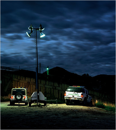
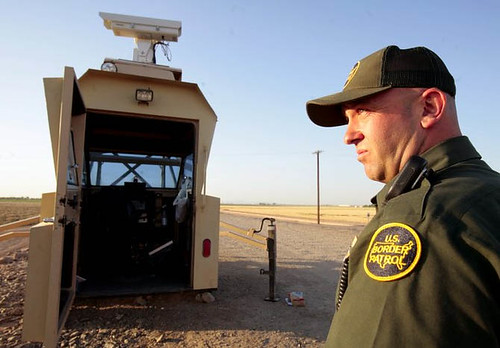
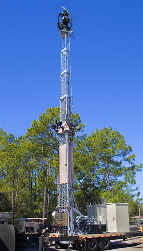
full-circle feel (remember, we started with the American Wall in Baghdad). So, a few days ago I broke down most of what the U.S. government is doing along the U.S. Mexico border via the SBINet. Check it out, if you missed it. But besides Sasabe, 
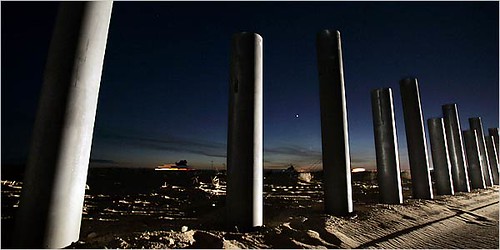
other fencing work still carries on, mostly in Arizona now which is by far the most impacted border enforcement state in the U.S. right now. Some relatively new vehicle barriers in western Arizona have begun to topple the landscape in addition to barriers along the southern boundary of the Buenos Aires National Wildlife Refuge.

National Guard troopers are installing X-shaped barriers made of railroad track. They resemble the barriers German troops installed along the Normandy beach in World War II to thwart allied invasion boats.

The new vehicle barriers are going up along a 37-mile stretch at the Barry M. Goldwater Bombing Range east of Yuma. But the barriers won’t be used at the nearby Cabeza Prieta National Wildlife Refuge.

And while European Union foreign policy chief Javier Solana delivered a recent scathing statement about walling La Linea, saying “immigrants should be treated like people and not like criminals,” (and while I agree with and appreciate his criticism) he should also then be willing to address what is taking place in Spain and all along the North African frontier where Europe has outsourced a vast detention front to treat African immigrants like criminals on soil just outside their own.

Nevertheless, Homeland Security oficials are conducting public dialogues with many of the Rio Grande’s landowners to determine the feasibility and public tolerance of establishing border fencing and different barriers on private ranches there. Many, as you might not expect, are skeptical of the plan, and see the fence as creating worse conflicts than the current situation.


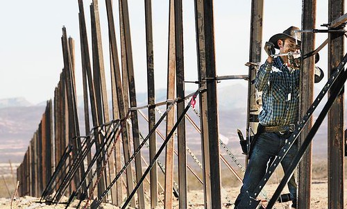
[Image: Minuteman fence rising on border ranch, Arizona Daily Star.]

But, others are much more willing to turn over their property to the hubris of border militarization. And guess who's there to capitalize on that offer? Yup, those crazy whacky dudes you just can’t get any more annoyed by – the Minutemen. You got to hand it to them, though, they do somewhat have their shit together (in terms of being able to mobilize). They have been quite successful at raising thousands of dollars and organizing massive volunteer efforts with their own Civil Defense Corps to build large extensions of fencing all over the place. They just finished a 7 ½ mile barbed wire fence on a Palominas ranch in Arizona. Last fall, the Minuteman Civil Defense Corps broke ground on a second fence project about four miles east of Naco on private ranch. When completed, the barrier is expected to cost about $650,000. However, "A shortage of funds and volunteer manpower has stalled plans by the Minuteman Civil Defense Corps to build a border fence at a private ranch near Bisbee Junction."

Everyone and their mother these days seems involved some how in the construction of a border fence. But, thankfully not without some at least minor but no less significant attempts at a counter balance.

Activists in the Netherlands recently cut away a protective fence at a port housing a new fleet of prison hulks that are set to go into operation. Such vessels are essentially floating prisons capable of housing large groups of immigrants for extended periods of time.


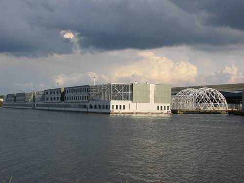
[Image: 'opening' of prison boats' in the Netherlands, via delete the border and Indymedia.]

What can I say, I love their garb, their mission, their tact. If any readers out there have been hawking news on these prison vessels, please contact me, would love to get some more scoop.


But hey, it's not only the U.S. in the land of the Americas who are building bombastic border fences. Brazil confirmed that it will build a steel and concrete wall along the Paraguayan border "to help combat contraband in the Triple frontier area where Brazil, Argentina and Paraguay meet."

According to the official Agência Brasil, the one mile long by three meters high wall perpendicular to the river Paraná, and next to the Brazilian city of Foz de Iguaçu, should be finished by next July and will be equipped with all the gadgets common to a high security presidium.

The purpose of the wall, say Brazilian authorities, is to stop smugglers from buying cheap imported goods in Paraguay's Ciudad del Este and selling them in the big Brazilian cities such as São Paulo. Computers, electronics, cigarettes, watches, brand textiles are some of the most common items smuggled.

Brazil, which has a significant Arab community has always rejected US claims that the Triple frontier area has become an operational base for Middle East fundamentalists and extremists. However, according to the Brazilian press, strangely enough the initiative was leaked during the visit to Brazil of US president George Bush.

More info on the political context here and here.

In more absurd contestations of border wall construction, a couple in Canada are challenging the government after building a retaining wall, “which border officials say must be moved back two feet, just south of the U.S.-Canadian border in Blaine, Wash.” As it was apparently built too close, “or more accurately,” according to this article, “right on the border.” From the same source we learn that “No construction is allowed and no trees or shrubs can be planted in the 20-foot buffer zone.”

And in case you wonder about the significance of the greater struggle to bring down the walls and force the more conscientious alternative, we are reminded by this story that no wall is too small to keep fighting the good fight. Some small group of residents in Contra Costa County, California, have been struggling for a decade now to have a simple chain link fence removed from the end of their road that leads to a park, where once drug dealers used a house there to conduct their business. However, locals and even city officials recognize that since the house has been reoccupied and with the barrier the drug activity has receded into the park, where ironically the police can no longer access or patrol due to the chain link fence. Most residents there have voiced that they want the fence removed, but due to some official department jurisdiction issue and funding excuses the city still has failed to take any action. Now the group of fed-up locals are planning to rip the thing out of the ground themselves, as they contend the fence has long prevented multiple road access to their neighborhood and homes and discourages their own use of the nearby park.

Go people go!

Anyway, all this is more to the point – that the walls never grow any less political over time. In fact, the opposite seems more true – border to border, wall to wall, fence to fence, the politics of movement never stops taking shape or assuming new spatial forms, neither does it cease to affront us, even in the most subtle of ways. And unless communities rally, like they did in Baghdad, or the Netherlands, and along the U.S./Mexico border, and so on, these partitions will go on cleavering the landscape and insinuating themselves as the built emblems of a colossally skewed distribution of global income, disingenuous labor practice, and informal warehousing of the poor. A significant minority of the world will in essence be turned into a giant gated community while leaving a majority to perpetually wander along side a new great wall of capitalist exclusion, of sorts, looking for some way into the Promised Land. Not the future any of us want to imagine, is it?

Previously:
Casting the SBINet : Stealth Wall Removal : At the Checkpoint : The Green Line : Face to Face : U.S. vs. Mexico (Border Ball is on!) : Border Fences-R-Us : Great Wall Preservatives : A Porcelain Fence : 'Tactical Infrastructure' and the 'Border Calculus' : Wall(s) of Light : The Participatory Panopticon at the border... : Resist the Apartheid Walls, from Palestine to Mexico : More Fence Sprouts : An Embroidered Wall : The Saudi's Immigrant-hunting Border Fence : Padua's Berlin Wall : Welcome to America : Call it 'Border Ball' : An Equator of Borderzones : urban syntax: at the border... : "Thinking of Walls" : Border CTRL : Rival Actions: at the border... : Bethlehem Prison City Gates : Three Ehxibits: on Walls & Political Divide

Monday, April 23, 2007

The Secret Making of an Execution Chamber


[Image: Photo by Liz Hafalia for the SF Chrinicle, 2007.]

State legislators and officials in Marin County have been debating for years now about what to do with San Quentin State Prison. The facility is notorious for its subhuman health conditions said to be the worst in the state. There is a large $337m expansion plan that has been kicked back and forth now, which would tear down and modernize the prison. While the prison sits on some of the most precious Bay Area real estate, many have fought to oppose the expansion in favor of developing much needed affordable housing. But, even though legislators have approved a significant portion of the funding, in case the expansion plan somehow meets approval, Arnold has apparently been slipping some other developments in the project past legislators' knowledge.
The story broke a few days ago, but needless to say Marin County and State officials overseeing the expansion project were pretty infuriated when they discovered that some of the money approved had already gone into much construction for a new execution chamber. Public outcry has currently haled its construction, even though it is already %82 finished. However, the secret work done on the new spacious execution chamber could sink the whole prison expansion plan for good. While the question of where to put current prisoners if the facility is torn down and a new one is not built is a crucial question, the expansion of a new prison project will surely only add to the prison problem in this state, which has become a billion dollar business hand in hand with an overcriminalizing justice system. To rethink San Quentin in favor of abolishing it is to reconsider the more dubious landscape of the criminal system and how it too must be retooled in favor of more effective alternatives to mass incarceration.

If neither option impresses you, just take a look at the China model: Death Vans (craziness!).

Tuesday, April 17, 2007

Peering into the Arenas of War


[Image: "Chicago" is an Israeli Defense Force urban warfare training facility in Israel, photographed by Adam Broomberg and Oliver Chanarin.]

In the latest issue of New Left Review, Stephen Graham (whom I will be featuring in a more in depth interview here in the upcoming weeks) takes us on a tour of the surreal – and more often than not, all-too-real – hybrid geographies of the Pentagon’s warfare-simulation industrial-complex that is gearing up American soldiers for an indeterminate future-long battle in the world’s urban centers.
“A hidden archipelago of mini-cities is now being constructed across the U.S. sunbelt,” he writes, “presenting a jarring contrast to the surrounding stripmall suburbia” where entire urban replications of Third World cityscapes are also rising out of the deserts of Kuwait and Israel, the downs of Southern England, the plains of Germany and the islands of Singapore.


[Image: "Mock Iraqi Villages in Mojave Prepare Troops for Battle," New York Times, 2006]

You’ve no doubt read about some of these places before, perhaps even here as I have mentioned a few, but for those who haven’t – these aren’t your scrappy run-of-the-mill warehouse-sized training modules with a few ramshackle rooms and actors set up to mimic a hostile situation. No, hardly. These secretive camps occupy vast tracts of outback acreage all over the world, featuring literally hundreds of built structures, thousands of actors, not to mention smaller details like having the call-to-prayer looped on an audio tape, or an assortment of chemical vapor machines to simulate the fetid stenches of death.

“In a mirror-image reversal of the more familiar global marketing contests in which cities parade their gentrification, cultural planning and boosterism, here the marks of success are decay and an architecture of collapse.”


[Image: Baghdad, USA, Wired Magazine, June 2006, photo by Jay L. Clendenin.]

It is an industry of controlled destruction, calculated architectural annihilation -- there are houses permanently left in ruins, bridges repeatedly built in order to be demolished, Mosques that become shooting ranges, trees that were never planted but rather scorched and grown to burn; mock explosions occur that could only be operated by Hollywood’s finest effects supervisors; and there are even rats and cows that have been imported while manmade swamps swim with thousands of toy snakes. We are talking entire theme-camps of war where the boundaries between reality and simulation have become so ambiguously blurred that practicing soldiers have been known to lose all perspective on which is which, as war and training become all the more seamlessly one and the same.


[Image: Baghdad, USA, Wired Magazine, June 2006, photo by Jay L. Clendenin.]

“Unmarked on maps, and largely unnoticed by urban-design, architecture and planning communities, these sites constitute a kind of shadow global-city system. They are capsules of space designed to mimic the strategic environment of the ‘feral city’, as one U.S. military theorist has called it—now seen as a critical arena for future wars.”

Graham goes on to brief us on the shifts in doctrine that began to percolate after WWII realizing that future wars would no longer be solely fought from the skies with a superior Air Force casting foreign cities as mere targets, but how the new battlefield would become an increasingly intense urban engagement with the Third World as it continued to undergo dramatic urbanization through out the century, while also remaining disconnected from the social infrastructure of the globalized First world.

“To address future ‘Military Operations on Urban Terrain’ training needs, the RAND team recommendations include the construction of four new ‘cities’, with more than 300 structures each. By 2010, the Pentagon plans to have over sixty MOUT training zones around the world. While some will be little more than air-portable sets of containers, others will be extensive sites that mimic whole city districts, with ‘airports’ or surrounding ‘countryside’.”


[Image: When War Games Meet Video Games, Wired Magazine, 2004.]

Pointing out several arenas of war that have already set a certain precedence, we learn that the Zussman Village at Fort Knox, Kentucky is “One of the most important new urban-warfare training facilities” in the mix. It is a 30-acre sprawl of $13 million translated into a quasi-city designed for the sole purpose of being attacked over and over again. There are also some spectacular camps like Fort Wainwright in Alaska, and the prominent training center on the U.S. Baumholder Base in Germany. The biggest U.S. urban-warfare complex of them all, however, is the continually expanding Joint Readiness Training Center at Fort Polk, Louisiana. “Eighteen mock-Iraqi villages are being constructed in this 100,000-acre site.”
Continuing to cite the RAND report, Graham tells us that “the most ambitious suggestion” targets California at the Marines’ Twentynine Palms Base where the aim is to construct “a 20 x 20 km ‘mega-MOUT’ complex” that “incorporates a complete 900-building town” in the California desert, with an estimated cost of $330 million and that could be operational by 2011. “Such a complex would allow an entire brigade to simulate taking a large Iraqi town, including port and industrial facilities, with unprecedented levels of realism.” The report also looks at garrisoning abandoned sites and structures throughout the country: abandoned factories, strip malls, schools, hospitals and entertainment complexes. There is an old copper-mining town in New Mexico that has apparently been used to perfect the art of the suburban raid, an outfit that even employs the few remaining residents there as actors.


[Image: The Urban Terrain Module (UTM), photo via techrizon.]

In addition to the unmistakably real places of the MOUT agenda, his article also rounds up several examples of where training has taken to the virtual domains of city-making and city-conquering. There is the ‘Urban Terrain Module’ at Fort Sill in Oklahoma, for example, and of course, the ‘Urban Resolve’ project, put together back in 2004 to create an unparalleled virtual model of almost the entirety of Iraq, with scaled cities and buildings that boast being within 1 meter of perfect accuracy. There are several other projects Graham discusses, not to mention the plethora of video games which have advanced both a technological profundity for depicting the urban battlefield, even engaging it in some way, as well as an equally dangerous vehicle for propelling military propaganda which also demonstrate “the extent of the American entertainment industry’s commitment to ‘a culture of permanent war.’"


[Image: "Chicago" is an Israeli Defense Force urban warfare training facility in Israel, photographed by Adam Broomberg and Oliver Chanarin.]

All of these urban-warfare simulations combined, however, work together as a kind of larger landscape collective, a hybrid-geography of “complex and self-reinforcing connections between war and entertainment” which serve to devise an alarming spatial complicity “by collapsing the real with the artificed, to the extent that any simple boundary between the two disappears.” In the end, Graham’s argument shows how the only role for Arab cities in the eyes of the west seems to be "as a terrain for urban war.”

Unfortuantely the article War and the City isn't online yet, but it should be in the next few weeks, I think, so keep your eyes out for it.

Also check out: The "Village"; Tracking Blackwater in Potrero; Sim Baghdad; War Room; Peripheral Milit_Urb 5; Cities Made by War; Good Buildings, Bad Buildings; A miniature city waiting for attack; War Play

Sunday, April 15, 2007

The "Village"


[Image: In his large-format light box, Yaron Leshem undermines our assumptions about the veracity of a landscape photograph. This panorama initially appears to be a benevolent view of an Arab village nestled in a hillside. Only when observed from close up does the photograph reveal that it is a three-dimensional simulation of an Arab village down to the fake building facade paintings of a nargila-smoking older man and a young man with a backpack running through a narrow street. The village seen here was built by the Israeli Defense Force in order to prepare soldiers to fight in Palestinian villages, and during his military service Leshem trained in sham villages such as this. Village is composed of fifty digital photographs, merged seamlessly into a single image. Here, we see that a seemingly innocent rural scene can hide a far different reality—a location that was carefully chosen by the Israeli Military to enact full-scale war exercises.
Artist: Yaron Leshem, Village, 2004 (full panorama here), as featured in the exhibition Dateline Israel: New Photography and Video Art, showing at the Jewish Museum, March 10, 2007 - August 05, 2007. You can also read a critique of the show in the New York Times.]

Saturday, April 14, 2007

Casting the SBINet

Historically, in the last decade, the techno surveillance programming the American government has used along the U.S./Mexican border has proven vastly inefficient both at preventing illegal immigration and as a financial investment. We’re all aware that illegal immigration has hardly slowed but rather has just been pushed out to lesser obvious migration routes, and while the U.S. government outsources border security to mega-corporations like Boeing, the cost analysis of these projects long after the contract has been awarded keeps climbing higher and higher.


[Image: Sept. 22., 5 a.m.: The border near Naco, Ariz., under the watchful glare of security lights. Photo by Simon Norfolk, The Border Dividing Arizona, New York Times.]

A recent article in Govexec.com reminds us that the older detection systems the Immigration Naturalization Service were using in 1997 (which consisted of sensors and cameras connected to Border Patrol databases), really only covered about 2 percent of the border, most of which either broke down in the weather or were never able to accurately distinguish between animals and humans. Furthermore, “auditors claimed that the General Services Administration's Federal Technology Service, which handled the purchase of the system, had been ripped off by contractors overcharging by tens of millions of dollars for equipment that in some cases didn't work.”


[Image: Sept. 19, 4 a.m.: Two towns called Nogales, one in Arizona (foreground) and one in Mexico. Photo by Simon Norfolk, The Border Dividing Arizona, New York Times. Inceidentally, astronomers working from observation centrrs along the border are now warning about light pollution that is emanating from the rash of stadium lights that are cropping in different pockets and ports of entry, making their jobs extremely difficult. You read a bit more here.]

So, as of 2004 the Department of Homeland Security discontinued development of this older system all the while, according to the same article, looking into the plausibility of building a “virtual fence” which would more effectively interconnect all of the sensors and cameras through more advanced technology under the plan America’s Shield Initiative. But, as we learn, “DHS repeatedly pushed back the release date for the contract solicitation, and then never released it. The next incarnation of border protection was the Secure Border Initiative, announced in 2005.”


[Image: Photo by Simon Norfolk, The Border Dividing Arizona, New York Times.]

One of the main components of a Secure Border Initiative is the SBINet, for whom Boeing Co. has been tasked with tying all of the existing border technologies together with a new kind of network that would also provide agents with situational awareness technology so that essentially everyone could be on the same page anywhere along the border when it comes to monitoring, reporting and acting on it. The contract period itself, according to one writer from Washington Technology, is “three years, with three additional one-year options.” With a minimum dollar amount of $2 million, the maximum is “the full panoply of supplies and services to provide 6,000 miles of secure U.S. border.” So far, DHS officials estimate a $7.6 billion price tag for SBINet to ensure operations up to 2011. “The estimate includes $5.1 billion for development and deployment of fencing, roads, barriers, sensors, and command, control and communications equipment, and $2.5 billion for integrated logistics and operations support," - better known as a ‘tactical infrastructure.’
However, the Government Accountability Office reported having worries that there weren’t enough oversight mechanisms or clearly defined deliverable milestones in the contract to safeguard against possible significant cost overruns. “As of December 2006, the SBINet program office had not fully defined and implemented critical acquisition processes, such as project planning, process and product quality assurance, measurement and analysis and requirements management,” the GAO said. Some analysts are saying the SBINet could grow as big as $30b.
Adding to these fears of an open-ended and somewhat vaguely defined border security contract with Boeing Co., the good folks at Mother Jones have also pointed out that oversight of the Secure Border Initiative, like the SBINet, has also been outsourced. Apparently, the DHS has turned over jurisdiction of making sure the U.S. taxpayers won’t be ripped off to consulting firm Booz Allen Hamilton, Inc. So, even though the U.S. government has a track record of being had by contractors hired to secure America’s borders, officials still refuse to perform their own vigilance.
But wait, it gets even better. Democratic Representative Henry Waxman from LA reported that this consulting firm is a regular business partner with Boeing. So, are we to believe that this pre-existing relationship will help ensure a more reliable oversight, or might it only prompt new fears that proper oversight will be virtually impossible without a more objective actor?
The SBINet is supposed to establish at least five separate projects by the end of 2008, with surveillance systems outside Tucson, Ariz., Yuma, N.M. and the Barry Goldwater mountain range. These projects are also supposed to create a “Common Operating Picture” (COP) for border patrol agents that would give them the type of surveillance and networking infrastructure that would allow them to share information across a greater field much more rapidly.


[Image: Border Patrol agent, as pictured in the Washington Post, photo by Melina Mara.]

I wrote earlier about “Project 28” near Sasabe where a Boeing-led team of contractors are developing a surveillance landscape prototype along a 28-mile stretch of territory along the U.S/Mexico border, an 8-month long pilot program that is supposedly testing the effectiveness of a “virtual fence” which in the end may be able to be cloned in other areas along the border where geographies and conditions make more traditional double and triple layered border fencing less appropriate.
So, recently, some new reports have come out about the progress of this test patch surveillatopia. It looks like Boeing is showing off a new mobile sensor tower that stands 98’ tall on a platform that can be easily moved. “The tower houses cameras, radar, wireless data access points, communications and computer equipment, and a tower security system.” The first tower is set to be deployed in Tucson, Arizona sometime in mid-April, but there are plans for a total of nine right now at the end of May. These towers will be configured with the COP to assist Border Patrol agents, who, as we read, will receive special “upgraded vehicles with rugged laptops and satellite phones” to create more mobile tactical communications units in the field. You can wtch a KVOA News 4 video here.


[Image: Boeing Successfully Tests First SBInet Mobile Sensor Tower, April 04, 2007, News Release.]

Hmmm….that sure doesn’t sound too impressive.
So, far, I think $368 million has gone into “Project 28” and this is what they have to show for it? Surely, I am being too skeptical.
Anyhow, I found in another news article that SBINet program manager Greg Giddens of DHS’ Customs and Border Protetion, has “recently issued a task order for a new Fence Laboratory in Texas.” Yup, a Fence Laboratory.
Done are the days of stacking some stones in sturdy piles and sticking spears into the ground. According to the article, which is well worth a read, the lab will include experts from the Energy Department’s Sandia National Laboratories, the Texas Transportation Department and Boeing Co. to determine an entire range of border fences that would respond and match the challenges of certain corresponding landscapes.


[Image: Border fence construction, via the New York Times.]

The Fence Laboratory will apparently study the capability of designing and deploying “intelligent fences” with all the techno-sensorial bells and whistles, that will help narrow the “sensor-to-sheriff” gap, according to the Border Calculus which we covered earlier. Let me quote the article at length to explain:

With the calculus, “officials analyze the distance in space and lag in time between an illegal immigrant’s entry and an imaginary line, beyond which the Border Patrol’s interception capability almost vanishes.

Among desolate mountains or in deserts along the border, that “sensor-to-sheriff” gap represented by the distance between the border and the imaginary line of migrant escape into the interior can stretch for miles and days of foot travel.

At border regions within cities, the imaginary line comes very close to the border, and a migrant who gets only a few blocks away from the border can hop a bus and ride to safety. “The clock starts when they cross the border, not when we find out about it,” Giddens said.

The sensor-to-sheriff gap drives the SBInet program managers’ effort to put advanced devices providing continual data streams into the hands of Border Patrol agents.

So, the nomadic fortress that I am always yipping and yapping about – you know, the crazy notion that there might exist one day a single universally connected border fence expanding around the planet along some contested geopolitical fault line – may have just taken one step closer to a more imminent future. India’s border guard outfit Sashastra Seema Bal (SSB) just launched a new satellite-based initiative to link all 582 of their outposts along the borders with Bhutan and Nepal, a state-of-the-art system that will in theory create a more united surveillance front minimizing the gaps in between the outposts and the border enforcement’s ability to respond to breaches anywhere along the line.

On the opposite side of the spectrum from the omniscience of these satellites peering down over the border, a small company has been granted a contract from DHS to continue manufacturing and refining an already existent product, one that we’ve actually heard of before: Spy rocks. That's right, they're back!


[Image: McQ aiding in development A new kind of wall, April 07, 2007.]

Apparently, a small Stafford county defense contractor company has been using "smart rocks", as they are called, to spy on insurgents in the Middle East. Soon, according to this news piece, McQ “may be making sensors to help the Department of Homeland Security stop illegal immigrants and narcotics traffickers” along the U.S./Mexico border.
Just last month, Jay M. Cohen, the Under Secretary for DHS’ Science and Technology division, gave a small contract to McQ to investigate its iScout technology. “The iScout is a small, low-cost, unattended ground sensor” that the company has already developed for the Army. A device the size of a deck of cards, it can be stashed in fake rocks and hidden in a tangle of weeds and branches, and is “"smart" enough to distinguish between human beings and animals, and wirelessly beam alerts that could alert a Predator drone to fly in and use its imaging and radar capabilities to pinpoint border violations.”
To round out the espionage fertility of this bugged border landscape, according to the Narcosphere, a Mexican newspaper on March 5, El Centro, “exposed information about a contract given by the U.S. State Department to Verint Technology Incorporated, a New York-based company, to spy on communications in Mexico.” The company is supposedly “a leading provider of analytic software solutions for communications interception, digital video security and surveillance.” This, from the dispatch, is part of a joint U.S./Mexican agenda to be able to spy on certain communications activity that could help apprehend illicit smuggler and drug trafficking activity.

Imagine one day all of this technology fitting into the border fence like some open-source superstructure; the border fence as the ultimate militarized architecture, covered in stadium lights, pain ray guns, infrared night-vision super scopes, assorted vibration sensors, video recognition gun mounts, motion detectors, communications interception systems, mobile towers, subterranean magnetometers, acoustic radars, billions of square inches monitored by a vast new geological spectrum of spy rocks that can distinguish a worm from a snake from a cow from a young child; all automatically controlled by some satellite that messages drones and blimps and outpost networks where the National Guard and Border Patrol agents’ hold game-pad like devices that indicate the movements of everything existing around the border within miles and miles of meticulously surveyed radius.
What if the fence became so structurally prominent that detention facilities were embedded into it so that apprehended migrants somehow ended up existing inside the fence itself, becoming literal inhabitants of the wall? What if the border fence became an entire global membrane for international surveillance, cross border espionage, and the spatial practice of hidden detention? Or, if future wars were fought with bomb proof border fences alone, butressed by armored Caterpillar D9 bulldozers that haul this flexible wall around while scraping along the earth and imprisoning anything in its path, pushing forward like a great wave of urbicidal steel across the geopolitical landscape?
This is outrageously far-fetched and cynical, I know, but I can't help to wonder - what is the future of the border fence when entire laboratories are dedicated to making it “intelligent”? When every bit of technology under the sun somehow merges together to create an uber barrier between nations, or, perhaps between the world? What will the evolution of the border fence tell us 100 years from now about the integrity of the nation state, or the fractured hypocrisy of a so-called global village?

Wednesday, April 11, 2007

Stealth Wall Removal


[Image: This is a photo of a section of the Berlin Wall taken back in 1997 outside of the Postsdamer Platz in Berlin. I could not find a photo of the precise section that was removed with total confidence, but for more photos of the wall in this neighborhood visit Dailysoft.]

It looks like over the weekend the German government conducted a little stealth engineering mission. When residents near Potsdamer Platz in the centre of the once historically-divided city woke up to start their week, they found that an 18m high section of the Berlin Wall, one of the last few remaining remnants, had been completely removed.
Needless to say, people were shocked, some outraged, what had happened to the monumental fragments of their deepest history? If the wall were to be completely obliterated from the landscape, what physical evidence of this heritage would remain?
The BBC reports that the owner of that section of the wall had purchased it "from an East German border guard in the summer of 1990, shortly before German reunification on 3 October 1990." The demolitions as you may remember began in 1989. He had even previously been to court to have the section of the wall preserved as a cultural monument.
Nevertheless, this portion of the wall was removed without any dialogue with him or public notification, it was in fact conducted so privately that officials hoped it wouldn't even be noticed!
The whole incident has turned into a media fiasco when their secret plan failed.
Hilarious. Just now they have owned up to the fact that it was them and not some renegade anarchist wall removal crew that had some tourists and locals speculating. They say, the missing piece will be somehow re-incorporated into a new environment ministry building that is being built along side the Postsdamer Platz, according to a spokesman for the Federal Civil Engineering and Planning Office.
Anyway, something to keep your eyes on. And I thought it was actually a marvel of activism that may be replicated in other parts of the world. Oh well.
In the meantime, check out this earlier post on a proposed project using lasers and lights to trace an entire outline of the Berlin Wall's early geographic path for the 2009 20th anniversary celebration of its destruction: Wall(s) of Light.

Some more reports here:
The continued fall of the Berlin Wall
One of Last Remaining Chunks of Berlin Wall Disappears

Sunday, April 08, 2007

the graveyard of a defiant architecture at war


[Image: Gaza International Airport, photo by Richard Mosse, Polar Inertia, 2007.]

Polar Inertia, a neverending gem of a site, features the work of photographer Richard Mosse who has covered a wide and spectacular range of urban destruction, from the ruins of an earthquake littered Iran, to the battle wounds of Lebanon’s gouged urbanity.


[Image: Gaza International Airport, photo by Richard Mosse, Polar Inertia, 2007.]

Writing for Polar Inertia about the international airport that Bill Clinton once attended for its opening, Mosse says:
"It was fully operational until December 2001, when three Israeli tanks and an armoured bulldozer damaged the runway in an effort to contain the second intifada. But the main terminal building was left untouched. For almost five years, the airport’s staff continued to turn up for work in the morning in spite of the fact that the airport was no longer operational. There were no arrivals and no departures, but the check-in desk was still manned, and the baggage belts were run each day. It must have been a kind of Marie Celeste airport. I see it as one of those peculiar situations which one comes across in these places. Reality borders the absurd, and you can’t quite work out if the whole thing is comedy or tragedy."

He goes on to tell us that during the recent war with Lebanon the Israelis also decided to completely destroy the airport, even going so far as to engrave with bulldozers the letters IDF (in Hebrew) on the tarmac – as a kind of urbicidal branding – so that it could be read from the sky. Today, the airport is a ghostly museum of war that has been turned over to local looters.


[Image: Pakistan, showing earthquake damage to Balakot city centre, NWFP Pakistan, Nov 2005, photo by Richard Mosse.]

But Mosse’s work, not entirely dissimilar from some of Simon Norfolk’s, is in an eerily magnificent way a glorious tour through the graveyard of a defiant architecture at war. Buildings so blown out by bombs that they should not even be standing at all anymore, yet somehow they do, somehow they persist.


[Image: Iran, showing earthquake damage to family home in Bam, eastern Iran, March 2004. Photo by Richard Mosse.]


[Image: Bosnia, showing shelled offices of Bosnian daily newspaper, Oslobodenje (Serbo-Croat for liberty), June 2002, photo by Richard Mosse.]

Despite their brittle bodies that have completely caved in to the goliath forces of a shaken earth, architecture’s pathetic remains manage to resist an absolute death. They are, in all their pieces, still standing, and Mosse’s work depicts a sort of monolithic pride that cannot be overcome even in the face of all out tragedy, which in some inadvertent way perhaps reveals all the more these buildings’ own devotion to the cultures who have erected them and the people who have survived them.