Sunday, October 29, 2006

Ceuta and Melilla


The Migreurop network recently published The Black Book of Ceuta and Melilla as a testament to the attrocities that are being committed in the name of enforcing illegal Euro-African immigration and border control along the two Spanish north African enclaves. While the publication is online, it can only be read in French and Italian, unfortunately. However, the intro is in English and can be found here. The entire document is said to "feature analysis, photographs and extensive testimonies from migrants themselves, who are thus given the opportunity to describe their experiences of what EU institutions euphemistically refer to as an "integrated system to fight illegal immigration", which is repeatedly, and annoyingly, considering that migrants have been shot, abandoned to die in the desert, hunted down and detained in inhumane conditions, followed by the phrase while respecting hman rights."


(Thanks, Ange!)

Friday, October 20, 2006

'Conflict Urbanism': City of Collision


[Image: Photo by Larry Towell for the Moving Walls Exhibition.]

[First, forgive all the paraphrasing here, but, sometimes you just gotta do it.]

Sanat Akademisi, writes for Arkitera, "Almost eight decades of violent urban conflict have transformed Jerusalem into an extreme spatial configuration. From a Western perspective, Jerusalem is often regarded as unique: a place where colonial and terrorist violence blur distinctions between the military and the civilian. But as cities worldwide are increasingly subject to dramatic new security policies and preventative measures against real or imagined threats Jerusalem, as a laboratory of conflict urbanism is in fact closer than we think."


City of Collision: Jerusalem and the Architecture of Conflict Urbanism, is a new book edited by Philip Misselwitz who runs the project "Grenzgeografien", a cooperation between the University of the Arts Berlin (UdK), Institute for Urban Design (ETH Zürich), Bezalel Academy of Art and Design (Jerusalem) and the International Peace and Cooperation Centre IPCC (Jerusalem). Akademisi continues, saying the book "presents a vivid picture of a city in a permanent state of destruction and reinvention, hostage to political planning, collective fear and physical and mental walls but also strategies of resilience, individual exchange and transgression."

As I have not yet gotten my hands on this book, the title description goes on to add this: "After terrorist attacks in New York, London, and Madrid, the same can be said not just about the Middle East, but also Western metropolises. City of Collision is a thorough investigation of the current situation in Jerusalem from a trilateral perspective: Israeli, Palestinian, and a host of international experts from multiple disciplines. Architects, urbanists, geographers, anthropologists, and artists discuss the production and use of urban space under the conditions created by "intra-urban conflict." Thirty-five large-format thematic maps and graphics detailing the construction of security fences, urban enclaves, exclaves, and the often jarring juxtapositions created between highly developed and impoverished urban spaces are also included."


[Image: Photo by Larry Towell for the Moving Walls Exhibition.]

Philipp Misselwitz and Tim Rieniets recently published an excerpt in Monu Magazine, where they describe 'conflict urbanism' as having "produced a city where modernisation and adaptation always intertwine with political agendas. It is a city that changes its physical form, infrastructural systems and in an accelerated, at times almost daily fashion. Processes of urban change such as road planning, closures, construction of walls, fences, etc. that require year-long planning processes in Western cities can be implemented virtually over night – an uneasy, panicked ridden dynamism, that relies on the rapid implementation of facts on the ground. This permanent state of radical transformation has involved a dramatic, physical and demographic growth, as well as unprecedented decline and destruction."

The essay goes on to describe the key aspects that characterize a Conflict Urbanism, using Jerusalem’s present condition as a filter.

Misselwitz stated in an older interview, "As the 1967 border line is not clear anymore, you can no longer talk about two halves of the city, but rather two overlapping parallel towns which, despite this, are almost completely separate from each other. [...] The basic idea of Cities of Collision was first of all to develop an understanding for this extreme situation. On the other hand, we tried to discover bridges between these islands, which make the idea of a shared city appear conceivable. [...] The term "collision" is not negative for us, but designates a third mediation area which can make the differences culturally productive and improve day-to-day living."


[Image: Photo by Larry Towell for the Moving Walls Exhibition.]

A recent discussion panel with Sari Hanafi, Peter Marcuse, Eyal Weizman, and Peter Zlonicki (Professor for Urban Planning, Munich) entitled: Victims, Weapons or Mediators? Transformations in the relationship between contemporary cities and conflict, explored "the condition of contemporary cities in a world where distinctions between the military and the civilian, between real and constructed threats, between security measures and socio-economic or ethnic segregation are increasingly blurred. Considering North-American, European and Middle Eastern Cities, the panel will discuss how cities increasingly struggle to maintain urban settings for the mediation of difference and diversity. Can the extreme spatial segregation of Jerusalem be considered as a prototype for a future urban condition? Can the city that produced such radical conflict urbanism also serve as a laboratory for practices that undermine, erode and transgress this condition?"

With that, be sure to check out Michael Sorkin's book The Next Jerusalem. The Publisher's Weekly wrote this: "Responding to a 1997 Jerusalem architectural conference that excluded Palestinian participation, New York architect Sorkin organized a second conference on the fate of the city that took place in Bellagio, Italy, in 1999, with 25 Palestinians, Israelis and "others" (mostly Americans) participating in equal numbers. Taking an eventual two-state solution as a given, the participants came up with some ingenious plans for mutual cooperation and healing via architecture-everything from "displacing" contested sites in Jerusalem and relocating them elsewhere (such as moving the Western Wall to Safed and the Dome of the Rock to Nablus) to taking the informal sites of Arab and Jewish same-sex encounters as starting points for imagining interfaith relations. While the conference took place before the second intifada began, and thus also before September 11th, Sorkin finds that even looking at the book through those lenses, "nothing in its feeling or analysis shifts. A just and equitable peace remains the only hope.""


Now, if you haven't had enough of my paraphrasing, don't overlook the Jerusalem 2050 conference and design competition kicking off in January of 2007. "It seeks to understand what it would take to make Jerusalem , a city also known as Al Quds, claimed by two nations and central to three religions, "merely" a city, a place of difference and diversity in which contending ideas and citizenries can co-exist in benign, yet creative, ways.

In order to break out of the stalemate that has reinforced despair and conflict in Jerusalem, and relegated questions of urban livability to the back burner of national political diplomacy, the Jerusalem 2050 project aims to bypass the standard route of negotiation between "representative" peoples and turn instead to the liberating potential of imagination and design. Rather than aiming for unity or synthesis among competing parties in their plans for the city, we will encourage the production of bold and “non-negotiated” visions for Jerusalem, with the assumption being that only through such methods can there emerge a shared understanding of the basic urban conditions necessary for a tolerant and culturally vibrant city to flower, independent of ethnic or religious partisanship."

Cross-country pod-hoppin'


So, we get our hands on a few of these Kitahaus dealios, one for each of us. Get DARPA, actually, to hotrod them with heavy-duty flexible suspension kits. Make the stock model stilts on these things more like self-retractable spring-loaded robotic legs, or something, super bugged-like so that we can bounce around, crawl over crazy shit, or just tuck them in and roll when we have to. We stock ‘em full of essentials: Spanish wines, pistachios, fishing poles, a bag of carrots and apples for the juice bar, small freezers full of ice creams, five different cameras with eight or nine different lenses, an mp3 recorder, satellite dish, some night vision telescopes, assorted atlases, notebooks, sketch pads, libraries of music, blank cd’s, some synchronized headphones, my favorite pair of hiking grippers, and all of Vollmann’s Seven Dreams: A Book of North American Landscapes. And, of course, our laptops.


We set off on an adventurous spree of silly investigations, a li’l podular archisquad of intrepid bloggers on the move, hitting up secret sequels to Pruned’s self-replicating camouflaged landscapes, Bouphonia’s survey of the Great Lakes soon to be militarized and lead astray, and find an odd geomorphic impostor of BLDGBLOG’s Antarctic underground sphere-cathedral unearthing in a Utah canyon hymning in the wind. We tread lightly over the smuggler tunnels along the US/Mexico border so Subtopia can tickle its strange obsession with observing improvised migratory landscapes, and spend most of the time generally retracing the backroads of CSP’s Indian country to produce a road trip film about reverse-tracing the history and retrospective geography of Manifest Destiny. Eventually, we find a nice little spot to kick it on Javski’s re-envisioned post-militarized Vieques island utopia, editing and polishing in our mobile studios, sipping sugared drinks and soaking up dank sounds of the tropical forest until it's done; the first of many, each summer we drop out and meet up for some cross-country pod-hoppin' to decode different radical landscapes combing the CLUI-fringes, chasing film adventures, staging flitting moments of architectural protest, leaving photographic entrails and scrolling crazy stories in our suped-up pod-pusher trails; like an avant garde highway sign project suggesting subtle tours of the military's gun-belt, maps left in pit-stop diner menus of hidden government real-estates, or, perhaps directions to the nation's immigration detention archipelago; maybe we drop off a bunch of brochures in hotel lobbies advertising beautiful tourist trail-getaways leading to botched corporate disaster-scapes instead, filed away in the middle of nowhere.
Anyway, the Kitahaus website just went down, not sure what's up. So, needless to say, all this may have to wait. Oh well, I'm such a wannabe, anyway. Later.

(Kitahaus was spotted at Gizmag).

Wednesday, October 18, 2006

the innovation of desperation.


[Images: Referred to only as the "chair guy" by the photo-indexers for the U.S. Immigration and Customs Enforcement website, no other information is provided about this scenario. Though, I'm not even sure any is needed, since these images do a pretty good job of speaking for themselves. However, unlike these, they are no joke.]

Tuesday, October 17, 2006

More Fence Sprouts


[Image: A New Fence Is Added to a Border Town Already Split. Photo by Tamara Abdul Hadi for The New York Times.]

Well, you can add these to the misshapen run-on border circumference snaking around the globe that I’d like to eventually visualize in some pictorial crypto-geographic way, one day. However (im)permanent these piecemeal extensions may be, they add to this crude satellite-reared global fence phenomenon of a single militarized structure I can't seem to get out of my head, constantly repositioning itself along a more abstract equator of borderzones, shifting and tilting across hillsides and slopes for better position over the world. It is a rampant architecture of strangulation strategically working its semi-displaced, self-erasing, self-resurrecting pieces into play, like little fence sprouts popping up here and there in the scorching fertile climates of borderland warfare.
In a matter of a few weeks following the recent cease fire, the Israeli Army threw up a fence around the northern side of Ghajar, a historically border-plagued village straddling the Blue Line that is currently meant to separate Israel and Lebanon.


[Image: The Blue Line covers the Lebanese-Israeli border as well as the Lebanese-Golan Height border. - Wikipedia.]

Intended to separate the northern side of the village from the rest of Lebanon, the New York Times says “it amounts to a new occupation of their territory, potentially worsening tensions over the disputed Shabaa Farms area nearby.” Israel insists the fence is merely a means to prevent Hezbollah from using the village as a southern bunker, which it did during the conflict, and apparently still does as a drugs-for-information outpost. But Lebanese officials say it is yet another insidious form of occupation. Of course, none of this territorial tension is new to the roughly 2,500 people who have lived in this inadvertently tactical village.
“In 1932, the residents of Ghajar,” we are reminded, were mostly from the Alawite sect, and "were given the option of choosing their nationality and overwhelmingly chose to be a part of Syria, which has a sizable Alawite minority. When Israel conquered the Golan Heights in the Arab-Israeli war of 1967, the town fell under Israeli control. Many residents were given permits to work in Israel and were eventually granted Israeli citizenship. When Israel invaded Lebanon in 1978, the town began growing northward into Lebanese territory. The town’s future grew more complicated when Israel withdrew from southern Lebanon in 2000, leaving two-fifths of the town in Israel and the rest on Lebanese soil, across the so-called Blue Line demarcating the borders between the countries.”
Interestingly enough, there was a small snippet in the JPost about IDF orders to remove the fence, but, I think, sadly, it would probably be safe to add this one to the Subtopian cartography of longer term resident border fences.


[Image: Barbed wire fencing lining the Yalu River that separates North Korea and China. Photos by AP.]

Adjacently, on the other side of the Asian continent, China, now facing the North Korean reality of at least some verified nuclear threat, is busy posting their own security fence. Mother Jones sums it up: "The project was approved back in 2003, but construction seems to have picked up in the wake of North Korea's now-confirmed nuclear test with about 1,600 feet of fencing built in the past week. Made of 8 to 15 feet tall concrete barriers connected by barbed wire, the fence runs mainly along the banks of the 100-foot wide Yalu River, fertile land for local farmers. The two countries share an 880-mile border, a vital trade route for North Korea, which gets 90 percent of its oil from China."
However, at the bottom of this article are some more telling details of the plan.
But the border became a security concern for Beijing in the past decade, as North Korea's economy collapsed and social order crumbled in some places. Tens of thousands of refugees began trickling across the border into northeast China, fording the Yalu and Tumen rivers or walking across the ice in winter.

Professor Kim Woo-jun, of the Institute of East and West Studies in Seoul, said China built wire fences on major defection routes along the Tumen River in a project that began in 2003, and since September this year, China has been building wire fences along the Yalu River.

"The move is mainly aimed at North Korean defectors," Kim said. "As the U.N. sanctions are enforced ... the number of defectors are likely to increase as the regime can't take care of its people. ... I think the wire fence work will likely go on to control this."

And so again, the security border fence building craze, in the end, isn't really about security or the threat of terrorists exploiting the border integrity of the nation-state. They're simple devices under the guise of security to confiscate land, stem migration flows, levee the rising tides of refugees, deny the immigrants access, slap the asylum seekers in the face. I just wonder, what does the world plan to do with this global floating population of millions of unwanteds banging their heads up against the wall? And all too frequently finding themselves bundled together now fitting the murky profile of some would-be terrorist?
So, I ask myself, under what circumstances would a securitized border fence be tolerable? Is it that I'm just opposed to every type of fence or wall out there? I don't think so. And, in fact I can't answer my own question, yet. But, perhaps it has to do with more about the moment when the fence begins to define the context rather than the other way around. Do border fences help address the exodus of the refugee, or only compound it? Do border fences help decide territorial disputes, or contain them in a state of perpetual irresolution? Do border fences protect asylum seekers from homeland persecution, or merely lock them in? Do border fences even prevent smugglers and illicit criminals from pushing their goods across the line?
(and on and on... you get my point.)

Sunday, October 15, 2006

a little guardian angel barricade...


[Image: Blanco Barricade, an installation by Matthijs Bosman, 2005.]

Not exactly a voided border, but perhaps another landscape poem, nonetheless. This innocent looking - dare I say, beautiful, even - blockade begs for a history, a raison d’être in this little corner of the world. This soft white cordon silently weeps for our attention.

Could this be the ghost of some past barricade, roaming these sad abandoned villa streets in search of the lost souls it once protected? Like the puritanical remains of a once bloody, little known, and now forgotten revolution here where a tiny squat of immigrants miraculously fended off the street-scraping evictions of an iron-fisted deportation campaign?


Or, is it the unrendered futurism of an unknown borderzone to come, a foreboding surrender to conflict lurking ever so quietly around the corner?
Perhaps, it is an alien barricade, a lost barricade, or, a magical windswept monument to civil upheaval wistfully wandering the globe, that will soon vanish, only to reappear again in some other curious place, like a nomadic settlement, or ramshackle shield for all those persecuted by abusive militancy. Is this a small but not insignificant counterpart to the nomadic fortress?
Like a little guardian angel barricade...

(via: artbbq kunstenaars verlinkt)

Friday, October 13, 2006

Peripheral Milit_Urb 11


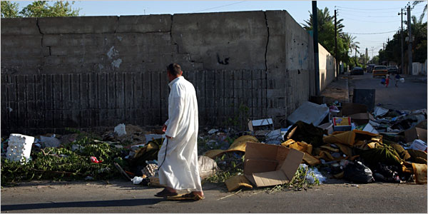
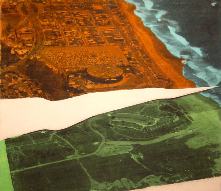
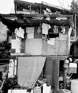
[Image: Washash, a poor district of Baghdad. Photo by Johan Spanner/Polaris, for The New York Times, Oct. 13, 2006.]

MIDEAST

In Afghanistan, US troops tackle aid projects - and skepticism
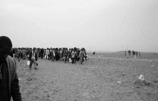
: Money talks in Afghanistan, particularly in this undeveloped region. Whether training local police or getting tips on insurgent positions, success for US forces depends on fulfilling promises of aid and reconstruction. That's the logic behind a new fight-and-build strategy that arms the US military with millions of dollars to spend on projects to convince Afghans, one village at a time, of the benefits of opposing Taliban-led militants.

Amy Goodman interviews former Baghdad bureau chief Rajiv Chandrasekaran who has written a behind-the-scenes account of the Bush administration appointees who ran Iraq after the US invasion.Imperial Life in the Emerald City: Inside Iraq’s Green Zone. "the more important tasks of actually rebuilding the country, of trying to find sustainable ways to increase electricity generation, to rebuild shattered hospitals and schools, to provide clean drinking water. All of those vastly more important tasks were sort of relegated, because the folks who came there saw Iraq as a terrarium for a number of neoconservative policies that they were never able to implement here in the United States."

At Checkpoints in Baghdad, Disguise Is a Lifesaving Ritual: At checkpoints set up by police or by sectarian militias, Iraqis said in interviews, it is common to hear questions such as "What is your sect?" or "What is your tribal name?" A wrong response could prove deadly. In Baghdad, it is difficult to tell a real checkpoint from a fake one. Police uniforms and badges are easily available on the black market. Shiite militiamen have infiltrated the Iraqi security forces, while Sunnis have largely remained outside them. Sunni insurgents have set up checkpoints and targeted Shiites.

Even Picking Up Trash Is a High Risk in Baghdad: In a city where a bomb could be lurking beneath any heap of refuse, and where insurgents are willing to kill to prevent them from being discovered, an occupation that pays only a few dollars a day has become one of the deadliest. Most of the 500 municipal workers who have been killed here since 2005 have been trash collectors, said Naeem al-Kaabi, the city’s deputy mayor.

Iran 'to open atomic site tours': Iran's president has ordered that the country's nuclear sites be opened to foreign tourists to prove its programme is peaceful, state media report. (via: heathering)

Without Renewable Power, U.S. Army Could Fail in Iraq: According to a 2004 study by the Rocky Mountain Institute, more than 50 percent of all fuel consumed in the battlefield is used by support units, not frontline troops. Before the recent rise in oil prices, the U.S. Army spent some $200 million annually on fuel and paid personnel an estimated $3.2 billion to transport it. The Defense Energy Support Center reports that in 2005, the U.S. military spent around $8 billion on some 128 million barrels of fuel; in 2004, it spent $7 billion on 145 million barrels. Zilmer’s memo estimates that a hybrid solar and wind power system, though expensive initially, would cut costs by 75 percent and pay for itself in 3­–5 years.

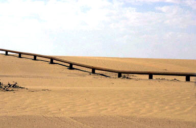
Patrolling the Shatt: Iraq has just two ports, Umm Qasr and Az Zubayr, in the south near Basra. Combined they generate 97% of the nation's revenue. Both are connected to the Persian Gulf by the polluted Shatt Al Arab waterway, which in lawless recent years has become a major artery for smugglers sneaking weapons, livestock and crude oil to and from Iran. Cracking down on these smugglers is a major priority of coalition and Iraqi forces. To this end, the Iraqi Navy patrols the Gulf end of the waterway in Rigid Hull Inflatable Boats and Fast Aluminum Boats -- that is, when they've got enough diesel fuel and spares for their boats' motors.

In Iraq, contractor deaths near 650, legal fog thickens: The war in Iraq has killed at least 647 civilian contractors to date, according to official figures that provide a stark reminder of the huge role of civilians in supporting the U.S. military.

Canada troops battle 10-foot Afghan marijuana plants: "We tried burning them with white phosphorous -- it didn't work. We tried burning them with diesel -- it didn't work. The plants are so full of water right now ... that we simply couldn't burn them," he said.

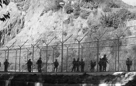
Gaza fishermen risk Israeli fire: Tens of thousands of Gazans depend on fishing, and - as their desperation has mounted - some have been putting out to sea regardless of the ban. This is an example of what a UN human rights observer recently described as "collective punishment" in the territory.

The World Is Not Enough: For a little less than an annual smoking habit, you can be briefed by Israeli spies, visit a West Bank checkpoint, tour the Lebanese frontlines, and travel in light aircraft over northern Israel.


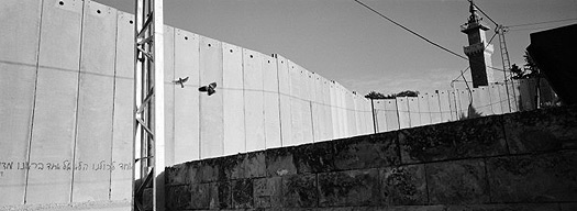
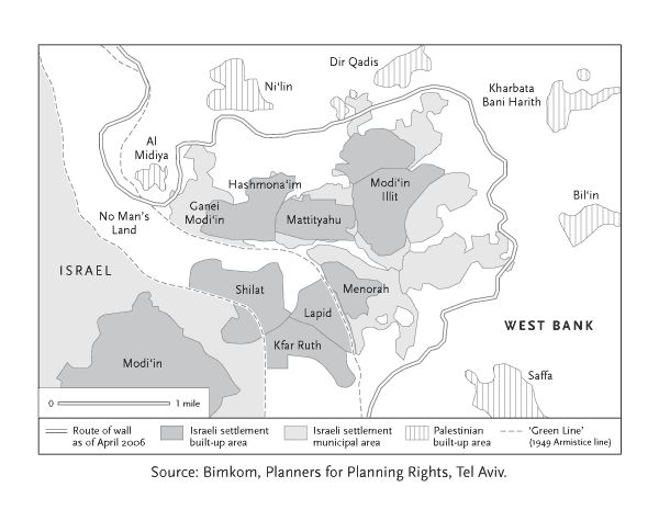
Offshore Zionism
by Gadi Algazi: How a militarized alliance of state-subsidized software firms, real-estate developers and captive Orthodox labour is forging the path of the Separation Wall in the Occupied Territories. Gadi Algazi writes a vey interesting piece for the New Left Review on using low-paid ultra-orthodox women workers in the settlement of Modi‘in Illit to annex parts of the West Bank.

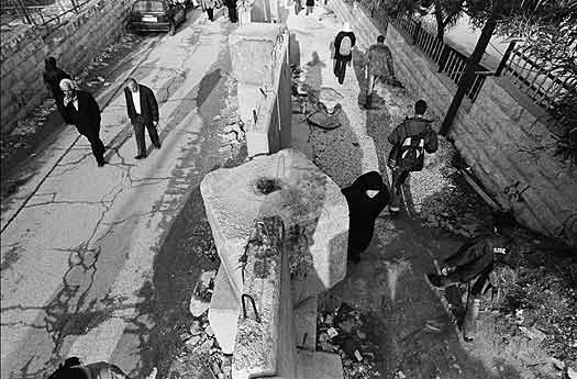
Security Barrier or Segregation Wall: the Politicization of Language and the Wall as a Geopolitical Tool: As George Orwell once stated, if thought corrupts language, language can also corrupt thought, suggesting that terminology in any political discourse can be actively recruited in shaping the nature of debate and the perception of any political issue. The construction of the West Bank barrier in the Occupied Palestinian Territories (OPT) is one of the most controversial and hotly debated issues in the Palestinian-Israeli conflict. Since the beginning of the wall’s construction in 2002, a whole range of terminologies have emerged reflecting the opposing perspectives on the wall’s fundamental purpose.

THE ARCHITECTURE OF POLITICS (CASE STUDY 'THE WALL') by Eyal Weizman: If the politics of architecture describe the mechanisms by which social, economic, national, and strategic forces solidify into the organization, form, and ornamentation of homes and cities, then the architecture of politics could describe the spatial organization of public action. Politics is carried out through the imagination, representation, construction, organization, transformation, erasure, and subversion of space. Space is thus not formed as a consequence of politics, but is the very medium within which politics is conducted.


OTHER RANDOM MILIT_URBS

Dave Zweifel: 
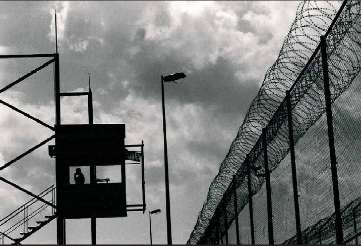
Fortress America is an ugly America (a recap of recent Blair Kamin article): "Capitol Hill is a zone of fear, welcoming the tourists with fences, slanted concrete barriers, steel walls that pop out of the pavement and steel posts called bollards that are designed to hold a vehicle-delivered bomb at bay," he wrote. "To visit here now is to realize that America has entered a new phase, in which various arms of the federal government have started replacing the temporary security measures installed in the aftermath of Oklahoma City and Sept. 11 with permanent ones."


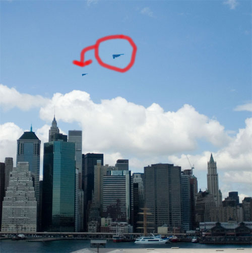
[Image: Gothamist reader David Shulman spotted a stealth bomber doing a little recon over Manhattan.]

With that said, an armed man crashed into the capitol barricade not long ago. Some weirdo. After that, however, some stealth bombers were seen swooping over Manhattan. Though, many of New York's security barriers are being removed: So far, barriers have been removed at 30 buildings out of an estimated 50 to 70 in the city. Officials, claim many of the barriers actually posed more risk than protection. A planter struck by a car would send shards of broken pieces into the air, and thus the bollard ceases to become defensive and now "weaponized". And irony wins again.

Tobyhanna Army Depot environmentalists believe they are the first to plant a garden on the roof of a Department of Defense building. Workers spent seven days covering the roof of one wing with about 1,500 pre-planted modules. The modules can be moved for future repair work as needed.
Also: more on the SkyBuilt.

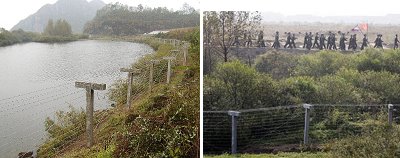
Ottawa sanctioned gunfire on Great Lakes: Deal inked in 2003 with Washington Allows armed drills by U.S. Coast Guard, that means Canadians my soon have to deal with U.S. military patrols along their border polluting the lakes with the ammunition from their drills. But not without some strong criticism.

Anti-Crime Program Provides 'Vaccination' Against Violence: Developed by a university professor, the CeaseFire campaign addresses violent crime as a public health issue, and uses a neighborhood-wide information and outreach campaign to help curb violent behavior before it occurs.

Architectural Evidence of War Crimes: Last week in the Hague, the UN war crimes tribunal found former Bosnian Serb leader, Momcilo Krajisnik, guilty of crimes against humanity based partly on the evidence of an expert in Ottoman architecture. Eleanor Hall spoke with Dr Andras Riedlmayer, the Director of Islamic Architecture at Harvard's Fine Arts Library, who has documented (pdf) the destruction of churches, mosques and libraries during the Bosnian Serb war.


[Image: Pruned wonders if the intelligence community has gotten Yongbyon all wrong.]

FROM THE BLOGGY-BLOGS

Climate Ghettos : Advertisement: Crowd Dynamics Ltd. : Yongbyon Family Complex
The Ring
Army "Big Brother" Unit Targets Bloggers
"a dark tale of globalization"
ARCHIS R.S.V.P EVENT 10: Beirut Unbuilt
Police demolishing shanties in Beirut
Property Rights in Favelas?
Polemos, police
Illegals Want to Hurt Your Dogs
Ghost Lab

Thursday, October 12, 2006

An Embroidered Wall


[Image: Shen Young's Proud of Being Dyed by Heroes' Blood is a "needle painting" and on average "requires more than one million stitches to get its three-dimensional effect, as opposed to the flat feel of traditional embroidery. Each painting takes a year to complete, working 10 hours per day." Insanity, but I like it. Spotted in the New York Arts Magazine, June 10, 2006. ]

Wednesday, October 11, 2006

"The Rain Forest" of Iraq


[Image: Heralded Iraq Police Academy a 'Disaster', Washington Post, 2006.]

From the Free Internet Press: "A $75 million project to build the largest police academy in Iraq has been so grossly mismanaged that the campus now poses health risks to recruits and might need to be partially demolished, U.S. investigators have found.
The Baghdad Police College, hailed as crucial to U.S. efforts to prepare Iraqis to take control of the country's security, was so poorly constructed that feces and urine rained from the ceilings in student barracks. Floors heaved inches off the ground and cracked apart. Water dripped so profusely in one room that it was dubbed "the rain forest"."
The firm responsible is Parsons, who had subcontracted it out to an Iraqi firm. However, the Washington Post mentions that "inspectors looked at 14 other projects Parsons was involved with in Iraq and found that 13 of those also did not meet standards. The only one that did was stopped because of cost over-runs."
Is this the penultimate symbol of Iraq right now?
Meanwhile, it was reported that nearly 665,000 Iraqis have died since the American occupation began, and thousands are fleeing their homes daily to seek refuge from the sectarian violence.

Tuesday, October 10, 2006

Non-borders, Anti-borders, and the Run-on border


Another one I missed, this time in Toronto. Bummer. Though, I think the concept sounds a lot cooler than the actual photographs appear. However, I only have these three images to go by, so, I sure would have liked to check them out in person. Anyway.
So, Nancy Duff has created a vision of a North American continent that treats the border in its absence by literally erasing them from the map, drawing an emphasis to the common geographies surrounding the voided border spaces, which she uses to sort of re-approximate the identities of Canada and Mexico neighboring a toxic super power like the U.S..
But, explaining it much better than I, the project [Borderdom] represents “the constant awareness of living next to the world’s super power. This double-edged reality is experienced asymmetrically, yet profoundly by the northern and southern neighbours of the U.S.; however, both neighbours perceive America’s projected anxieties without, perhaps, being seen to have differing points of view.”
The YYZ Artists’ Outlet describes the project further:

Through aerial views of the North American body as seen along its international borders, together with references to the undocumented and unregulated movement of people, pathogens, elements of “criminality,” and subversive ideas, BORDERDOM examines the veins and arteries of roadways and waterways that circulate the lifeblood of commerce and culture through the continental corpus. But is the body healthy? Are the bloodlines of North American life tainted with diseases like xenophobia, homophobia, cultural imperialism and conflicting interpretations of home and belonging?


These questions are filtered through a primarily Canadian perspective – if North America is the body, then Canada is its eyes and mind, the USA its beating heart, and Mexico its pumping legs. The eyes see, the mind considers, and the feet are swift – but what of the health of the hidden heart? Does the patriotic hand serve to strengthen the organ, or reinforce its isolation from the rest of the body? The so-called longest undefended border is examined with its NAFTA complement, as conflicted sites of cultural and economic inhabitation, influence, colonization, contamination and exchange.

Peter Goddard for the Toronto Star calls Duffy’s aerial finalities “anti-borders”, and likens them to those innocuous strips that run down the center of the highway. Or even, the lane dividers. Sure they are borders, but they are not real barriers, but rather a broken chain of boundary prescriptions, or, an endless supply of implicit space striping the arterial landscapes of the continent’s migratory-sphere. And Duffy’s images kind of evidence the same, by reducing the political boundaries between nation-states in a similar sort of way, mocking them by removing them, almost to the point of being revealed as pure landscape fictions.
As hardened as the world's borders are becoming, how much of their existence stands as purely an imaginary boundary? A perceived border, an othering of place? And without the borders, what would be left in terms of geographic similarities, cultural (in)congruities, what is the essence of geopolitical division when the borders disappear?


But, part of what’s so interesting to me about the border is how it is such a locus of diversity; a site of conflict, yes, but also cultural explosion. So, as much as I would be interested in seeing this project on a global scale, I’d also love to see the opposite: a photographic collection of all the world’s borderzones themselves, to examine the similarities or differences of those demographics. Just like the world might look incredibly self-cloned in the absence of the borderzone, how corresponding might all of these separate borderzones look when framed out of context and placed next to each other, side-by-side in one run-on string of aerial shots? One run-on border geography?
Anyway, I'm not exactly sure what I'm saying, but I sure would like to catch this project somewhere, and maybe bust out Google Earth and try building an endless comparative borderzone cartography of my own. Whatever.

[All images by Nancy Duff, BORDERDOM, 2006.]

MexiCali Style


[Image: Oragami Road Signs, Andrew Armstrong, 1998.]

Just came across this. Following the lead of in_Site05 and Strange New World, and probably tons of other cool exhibition/intervention/art events I sadly cannot even name, there is now the MexiCali Biennial, that just kicked off this year opening last Saturday, October 7th.
The 2006 MexiCali Biennial spans two events across the US-Mexico border. First, an exhibition of thirteen Los Angeles-based artists in Mexicali, Baja California, Mexico. The second event is a multi-media show with visual artists, live bands and DJs from both Los Angeles and Mexicali in East Los Angeles, California. More info about the schedule here.


[Image: MexiCali, Calexico. Courteousy of MexiCali Biennial, 2006.]

From the website:
The concept for the MexiCali Biennial is to provide a platform for border crossing contemporary art exhibitions. These exhibitions will features artists from southern California and the bordering Mexican states. the MexiCali Biennial may occur on either side of the U.S.-Mexican boders...[it} will provide an opportunity for artists to exhibit their work internationally and engage with the surrounding condition of the exhibition sites. This exchangeprocess will facilitate open dialogues with both artists and audiences through the sharing of culture.


[Image: Blackhawks mixed media on didactic panles, Ed Gomez.]

Projects involve on and off-site installations and border-crossing interventions including Ed Gomez's 100 Envelopes from Los Angeles to Mexicali, consisting of 100 envelopes mailed between California and Mexico each containing a one-inch section of a map of the US-Mexican border, to be reassembled in the gallery. Mike Rogers fosters communication in his installation entitled "Telephone/Teléfono" consisting of two 10-foot telephone poles on either side of the border fence separating Calexico and Mexicali, connected by the string and tin cans of a child's telephone game. Cindy Santos Bravo's multi-layered construction investigates histories of imposed security barriers across international borders.


[Image: Ben Gurion Airport, Cindy Sanos Bravo.]

So, well, yeah, if you're in L.A., or even anywhere near it, go check it out - just do it, DO IT - and let us know what you think.

(via: art.blogging.la)

Sunday, October 08, 2006

The Saudi's Immigrant-hunting Border Fence (the nomadic fortress part 2)


[Image: Map of proposed Saudi border fence along Iraq border. From Saudis build 550-mile fence to shut out Iraq, 01/10/2006.]

With the utterly abysmal situation in Iraq, the Saudi government now sees it as imperative to build a security fence along its 560 mile stretch of northern frontier, which is essentially a barren desert patrolled right now at best, according to this article, by 100 sniffer-dog teams. While it is not clear whether the fence would stretch the entire distance along the border or just at key crossing points, the $500m upgrade will surely bring their project comparisons to other border precedents around the world, namely the Israeli security barrier, the massive migration fence in southern Spain, and potentially the next phase of wall-building along 700 miles of the U.S./Mexico border.
This hi-tech ‘state-of-the-art’ Saudi barrier would typically have a double fence running 100 yards apart with 135 electronically controlled gates, fence-mounted movement detection sensors, a web of buried radio detection sensor cables tendriling under a hotbed of baking sand, and will also combine an array of ultraviolet night-vision cameras with face-recognition software processesing and relaying pictures back to a network of new security bases with heliports and dispatch patrols, not to mention a few new sand berms and thousands of miles of razor barbed wire. With all of that, it is suprising the fence won’t be electrified.


[Image: From Saudis Plan Fence Along Iraq Border, published on 9/28/2006.]

This is all part of a larger centralized and more sophisticated security plan which is bracing for anotheer type of attack: a potential “blowback” from Iraq, you know, just in case it gets worse. And, tragically enough, it probably can and will. This article states, “they are mostly concerned that an Iraqi civil war will send a wave of refugees south, unsettling the kingdom's Shia minority in its oil-producing east,” as well as a new invasion of militant insurgents that would pour into their country. However, Time magazine makes this simple point: This fence “will not ensure Saudi Arabia's security. The kingdom has had at least five deadly terrorist attacks since 2003, and some of the perpetrators were homegrown.”
More alarming, however, is this claim in The Telegraph:
For Saudi Arabia, terrorists and refugees from the conflict are not the only unwelcome intruders.
"We suffer badly from illegal immigration, as well as the smuggling of drugs, weapons and even prostitutes," said Mr Obaid. "It is becoming a major issue."
Despite the details emerging about the fence, Saudi Arabia's military is keeping some aspects under wraps. According to one source, the project is being kept so secret that military officials from Centcom, America's central command responsible for Iraq, have been told they cannot inspect the site on "national security" grounds.
Even spy satellites will not be able to unravel the fence's secrets. The source speculated that the reason for the secrecy might be automated weapons systems attached to the fence that could fire on suspected smugglers or intruders.
"It's being done in true Saudi style," the source said. "State-of-the-art equipment and no expense spared."


[Image: A Saudi barrier is seen at the border line with Yemen. From Riyadh halts work on border barrier with Yemen, 2004.]

At the southeastern corner of the Saudi Arabian Peninsula, meanwhile, Yahoo News reports, the United Arab Emirates is building a barrier along its border with Oman.
An so, with the fall of the Berlin Wall it seems a whole new era of border fence construction has emerged in its place; a globalized spawn of separation walls insinuating themselves across the entire geopolitical landscape. What if they connected, literally, from the Korean DMZ to the Great Wall of China, snaking piecemeal sections of separation barrier on down to join the fence taking shape in Kashmir, continuing with even more fortification between Pakistan and India, and over to India/Bangladesh, falling even further south to catch up to the increasingly militarized boundary line stretching between Thailand, Malaysia and Burma; then, disappearing momentarily from radar only to ressurect in the Middle East, snaking up through Kyrgyzstan/Uzbekistan and eastern Europe, Padua, Italy, resting lazily between Russia Poland and Germany, with another segmented torso piece swelling along the strait of Gibraltar, scribling through a messy tangle of borders through out Africa emanating in a 10' electric fence between Botswana and Zimbabwe....all the missing segments carried on by an implicit line, so that eventually this massive barrier is stretched west whereby it mysteriously attaches itself once again to the scrappy disputed border fence mocking the border of U.S. and Mexico.
All the world's separation barriers joining together in a hegemonic solidarity of geopolitical exclusion, a global fortress wall isolating the developing world from the ranks of upwardly mobile integration. I wonder, if a single security fence connected all of these borderzones together and became visible from space, like some militarized architectural python preparing itself for a great global squeeze, how a geographic depiction of globalization might look then, all that "borderless" hyperbole dispelled and distilled into virtually two separate globally distorted continents? Imagine if this universal security fence were actually armed with a uniform hi-tech defensive camera and mounted-gun system (as the Saudi fence mystery alludes), imagine if this leviathan border fence one day became intelligent, autonomous, mobile, even, erasing territorial boundaries and violating national sovereignties all on its own with a single sweep of its modular and flexible architectonic tail?
Is it the future of architectural occupation, automated geoannexation, the grand device of the empire's new eminent domain campaign? The entire Third world turned into a globally fragmented detention center? A self-enclosing nomadic prison?
More likely just another delusion of my warped subtopian obsession with the military's hostile architectural takeover of the world. So then, move along, nothing to see here.

See: Globalization of Forced Migration, and the nomadic fortress (part 1)

Tuesday, October 03, 2006

Maps, Maps, Maps

In case you have a little map fetish, well then, I have a few here you might want to peep. Yeah, we got maps. Maps of the global arms trade, maps of destruction brought upon Lebanon by Isreal's recent bombing campaign, we've got a map of the business locations of the war profiteers of New York City. Maps that even trace the imperialist war torn history of the Middle East; interpretations of the spatial striation of incarceration in NYC; the densities of world poverty; maps that guage changing environments, flood levels even, as well as alert you to the planet's ongoing disasters. Hell, we've got a map that tracks the routes of the CIA's secret torture flights, the patterns of extraordinary rendition posted on a billboard for all to see.
Yes, sir. We got a few maps for ya. See?


Labanon Maps: The Maps of Israeli Assault on Lebanon are developed by a group of activists to demonstrate the reality of the Israeli assault on Lebanon. Maps based on Locations Bombed (larger image) and Transport and Vital Sites Bombed (larger image). With some extras here.


NYC Guide to War Profiteers (the “mutual support network”, 2003.)


The Privatization of War (Colombia as Laboratory and Iraq as Large-Scale Application, A mapping project by Lize Mogel and Dario Azzellini) (via: critical spatial practice)


A map of Selected CIA Aircraft Routes and Rendition Flights 2001-2006 (Three projects for the 2006 season of artists’ billboards produced by Clockshop. The participating artists are Trevor Paglen & John Emerson, Ignasi Aballi, and Nadiah Bamadhaj.)


Terminal Air: a dynamic information artwork that aggregates and visualizes torture taxi data. (Paglen, 2006.) (via: we-make-money-not-art.)


Maps of War: Who has controlled the Middle East over the course of history? Pretty much everyone. Egyptians, Turks, Jews, Romans, Arabs, Greeks, Persians, Europeans...the list goes on. Who will control the Middle East today? That is a much bigger question.


Architecture and Justice maps criminal justice statistics to make visible the geography of incarceration and return in New York, Phoenix, New Orleans, Wichita, and New Haven, prompting new ways of understanding the spatial dimension of an area of public policy with profound implications for American cities.


Choose Your Weapon (Mapping the Global Arms Trade)


UNEP: Atlas of Our Changing Environment (United Nations Environment Programme, interactive map observing climate change and environmental change.)


AlertMap: Real-time Disaster Events: "The Havaria Emergency and Disaster Information Services in Budapest Hungary, uses Google Maps to offer a real-time interactive display of the world's ongoing disasters, with clickable descriptions, coordinates, damage levels." (via: blog like you give a damn)


Flood maps: Dynamic maps of sea level rise. Gauge your region's danger zone here with this Google Earth retool.