A Subtopian Rainbow Under Your Feet
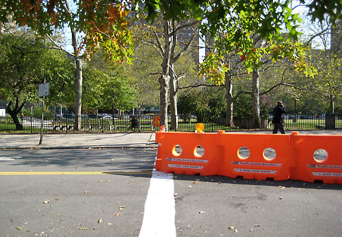
[Image: City draws the line against feds, The Brooklyn Paper, 2008.]
A relatively innocuous borderline has been literally drawn smack dab in the middle of downtown Brooklyn, we are told, absurdly enough, a “de-militarized “zone” only about one foot wide” to be exact.
Apparently there is a little turf war going on between the city’s construction workers and the federal employees at the site of the new federal courthouse, where both contingencies are vying for use (and perhaps control) of the parking lot. Funny. The line was painted by the city to advise construction workers to respectively stay on their own side with regards to storing equipment, parking, etc.
Even though it appears there is nothing really contentious going on, it’s interesting to see that an actual line has been painted on the street to make perfectly clear where city authority ends and federal power takes over. “Until 9-11," the Brooklyn Paper mentions, "the street (Camden Plaza East) was open for drivers, who could use it as a straight shot from Downtown to DUMBO. But after the terror attack, the feds seized it, citing security needs.”
I don’t know, I kind of like that the line was painted, for whatever reason. Makes me want to cruise around the nation, going city-to-city, with maps of each, some GPS nav gear, and maybe one of those professional pavement stripers you see city dudes driving in the middle of the street converted into my very own personal borderline striping chariot, and paint more of them -- federal versus local geographic lines in the city.
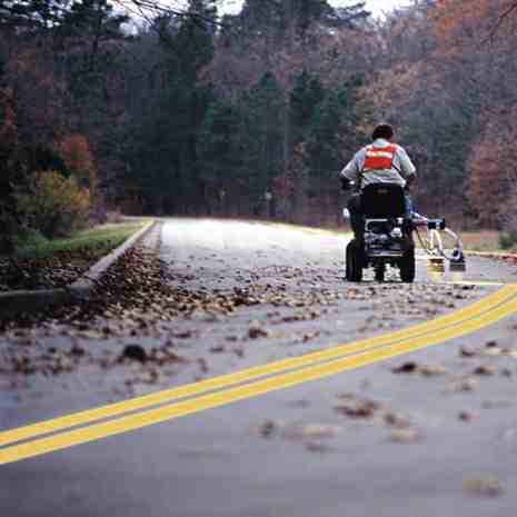
Better yet, what if geography departments in universities across the country coordinated a nationwide semester curriculum, so that each class could be responsible for marking similar boundaries in their own state’s prominent cities. The universal assignment would be just that: to simply roll around downtowns everywhere and outline all of the little unknown, unseen boundaries that exist between federal and local aauthorities as they are territorially distributed, on the streets, over sidewalks, in front of courthouses, underground in secret tunnels, around bollards, behind secret DHS buildings, ICE detention centers, weaving together districts of federal offices and military recruiter outposts in meandering perimeters of nice wet paint, for all to see; not missing, of course, the secret NSA listening rooms harboring in phone company HQ buildings, or the TSA interrogation rooms within airports, the research labs bellied in even the most liberal universities, old industrial sites, toxic brown sites, mysterious test sites, even new border fence property acquisitions, or national landmark buffers, and so on.
I would love to see an army of students and their professors invading the city with hordes of pavement stripers scrawling the margins of various no-access zones like mad, leaving nothing behind but a fresh coat of visibly territorialized entrails in their tracks. Along these trails there would be collection meters so that people could pitch in a few pennies for more paint.
Maybe once finished tracing the perimeters of the fed’s sovereign landscape within America's urban heartland in a nice and glossy black, the next semester these cryptic pavement stripers reveal another colored urban geography: the corporate privatizations of public space in royal blue; the following semester we find the redacted acreage of seized public park space marked in harsh lines of cement gray, and the next one after that the nation’s CCTV metro-surveillance grids appear on the streets in red, and the newly designated ‘free speech and protest zones’ in pink, then the anti-homeless panhandling spheres pop up around ATMs in green, the restricted day laborer gathering spaces on various street corners and parking lots appear in yellow, and on and on and on.
In the spirit of Ronen and Francis’ illuminated borders projects, I’d love to bring these subtle and unmarked boundaries to the surface, in a kind of crisscrossing rainbow of longitudes and latitudes similar to the guiding lines you find in hospitals on the floors and along the walls, where separate colors lead you to different quadrants and different departments within the hospital; a kind of architectural navigation system for the institution's compartmentalized bureacracy.
People could then tour these rainbow grids at lunch, or on the weekends, and just take a little cruise of the hidden geographies of America’s urban landscape, along the way dropping a little spare change into the meters so all the kids could be supplied with fresh paint for next semester.



3 Comments:
Hilarious. You're a wingnut, you know that?
Well, possibly. Which of the following were you intending to suggest?
* A wingnut or wing nut, a nut (hardware), with a pair of wings to enable it to be turned without tools
* Wingnut (plant) (Pterocarya), a genus of trees bearing winged nuts
* Wingnut (politics), a derogatory American slang term for a person who holds strongly right-wing political beliefs, shortened from "right wing nut".
* Wingnut, a term to describe a fan of the Detroit Red Wings
* Wingnut ear, a derogatory term for, or a person with, ears that stick out
* Wingnut (haircut), New Zealand slang for someone who had the "short-back and sides" haircut style of the 1940s and 50s
* Wingnut, military slang for members of the United States Air Force
* Wingnut, a term to describe a fan of the NBC television drama series The West Wing
* Wingnut, a person with a hobby-level of interest in the White House and its architecture, and/or the Presidency of the United States
* Wingnut, a name for an eccentric person.
Or, all of the above, none of the above, did I miss something?
Love it. Many realize but don't care that fedgov controls huge and growing swaths of ground in the states. Few pay attention to the overlapping zones of authority in their own cities...a crazy quilt of multi hued lines on the asphalt might just result in a few questions.
Post a Comment
<< Home